Category:Los Alcornocales Natural Park
Jump to navigation
Jump to search
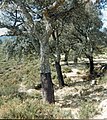
Español: El Parque Natural de Los Alcornocales es un parque natural de Andalucía situado entre las provincias de Cádiz y Málaga. Se extiende por varios municipios, principalmente de las comarcas gaditanas de La Janda, la Sierra de Cádiz y el Campo de Gibraltar.
|
This is a category about a Special Area of Conservation in Spain with the ID: ES0000049. Natura2000 entry, EEA entry
|
protected area in Andalusia, Spain | |||||
| Upload media | |||||
| Instance of | |||||
|---|---|---|---|---|---|
| Part of | |||||
| Location | |||||
| Applies to jurisdiction | |||||
| IUCN protected areas category | |||||
| Inception |
| ||||
| Area |
| ||||
 | |||||
Subcategories
This category has the following 17 subcategories, out of 17 total.
A
C
- Cañón de las Buitreras (7 F)
- Cueva de Bacinete (3 F)
- Cueva de la Alta Laja (2 F)
- Cueva de las Palomas, Tarifa (10 F)
E
- El Picacho (Andalusia) (11 F)
- Embalse del Charco Redondo (26 F)
L
- La Montera del Torero (5 F)
- Laguna del Moral (2 F)
M
P
- Pinares del Rey (14 F)
R
- Río de la Miel (15 F)
S
- Sendero del Monte Palancar (16 F)
Media in category "Los Alcornocales Natural Park"
The following 146 files are in this category, out of 146 total.
-
'Queens Bath' El Alhipe summit (33010329652).jpg 4,608 × 3,456; 6.14 MB
-
A-381 - P1590493.jpg 2,560 × 1,920; 2.86 MB
-
Alconocales National Park - Flickr - gailhampshire.jpg 2,267 × 1,440; 766 KB
-
Alcornoques "gemelos".jpg 2,592 × 1,944; 1.56 MB
-
Arco de piedra en Los Alcornocales.jpg 7,938 × 3,944; 11.25 MB
-
Arroyo de valdeinfierno. Los Barrios.jpg 4,000 × 3,000; 10.34 MB
-
Arroyo del sendero de valdeinfierno, Los barrios.jpg 4,000 × 3,000; 7.28 MB
-
Arroyo del sendero de valdeinfierno. Los Barrios.jpg 4,000 × 3,000; 9.21 MB
-
Atardecer en el pantano de castellar ,castellar de la frontera.jpg 4,000 × 3,000; 1.46 MB
-
Autovía A-381 - P1590479.jpg 2,560 × 1,920; 2.85 MB
-
Bark . Eucalypyus (31677201480).jpg 3,776 × 2,520; 1.94 MB
-
CaminoAlcornocales.jpg 2,048 × 1,536; 1.41 MB
-
Cao de la Real Fábrica de Artillería (Jimena de la Frontera) 2.jpg 1,536 × 2,048; 1.73 MB
-
Carteles Sendero de La Sauceda.jpg 3,456 × 2,304; 2.34 MB
-
Castellar de la Frontera al atardecer.jpg 3,872 × 2,592; 6.41 MB
-
Chozas informacion turistica.JPG 3,456 × 2,304; 4.08 MB
-
Desde la cima de El Aljibe 1.jpg 3,456 × 2,304; 2.82 MB
-
Desde la cima de El Aljibe 2.jpg 3,456 × 2,304; 3.45 MB
-
El corazón de la Comarca (cropped).jpg 1,500 × 621; 386 KB
-
El corazón de la Comarca.jpg 1,500 × 1,000; 476 KB
-
El peñón de Gibraltar desde el mirador del hoyo de don Pedro. Algeciras.jpg 4,592 × 3,056; 2.92 MB
-
El Pichacho nevado en Alcala de los Gazules.JPG 1,200 × 900; 383 KB
-
El Rio Guadiaro 01.jpg 2,560 × 1,920; 3.27 MB
-
El Rio Guadiaro 03.jpg 2,560 × 1,920; 4.02 MB
-
ElPicacho.jpg 2,048 × 1,536; 638 KB
-
Embalse de Guadarranque Mirador.jpg 2,560 × 1,920; 3.94 MB
-
Embalse de Guadarranque y Catellar de la Frontera.jpg 2,560 × 1,920; 3.64 MB
-
Embalse de Guadarranque.jpg 2,560 × 1,920; 4.17 MB
-
Entrada al Sendero de La Sauceda.jpg 2,304 × 3,456; 3.92 MB
-
Garganta de Bogas.JPG 4,608 × 3,456; 3.71 MB
-
Jimena Castle from Pinus pinea woods (32645096123).jpg 4,608 × 2,592; 3.51 MB
-
Korkeiche (Quercus suber) im Naturpark Los Alcornocales 3.JPG 2,560 × 1,920; 1.26 MB
-
Korkeiche (Quercus suber) im Naturpark Los Alcornocales 5.JPG 1,920 × 2,560; 1.18 MB
-
Korkeiche (Quercus suber) im Naturpark Los Alcornocales 6 - Detaillansicht.JPG 1,920 × 2,560; 693 KB
-
Korkeiche (Quercus suber) im Naturpark Los Alcornocales 8 - Detaillansicht.JPG 2,560 × 1,920; 1.25 MB
-
La Pilita de la Reina - panoramio.jpg 1,536 × 2,048; 1.34 MB
-
Laguna del Moral - panoramio.jpg 2,048 × 1,536; 1.28 MB
-
LagunaPicachoDesdePicacho.jpg 2,048 × 1,536; 1.46 MB
-
Loading cork oak bark in Reserva Nacional de Cortes de la Frontera 1987.jpg 6,122 × 3,456; 2.52 MB
-
Lone Oak (32967697785).jpg 4,608 × 2,592; 5.13 MB
-
Los Alcornocales 01.jpg 3,264 × 4,928; 2.67 MB
-
Los Alcornocales 03.jpg 3,264 × 4,928; 2.05 MB
-
Los alcornocales, cádiz.jpg 4,000 × 3,000; 5.5 MB
-
Los alcornocales1, cádiz.jpg 4,000 × 3,000; 4.2 MB
-
Los alcornocales2, cádiz.jpg 4,000 × 3,000; 3.55 MB
-
Los alcornocales3, cádiz.jpg 4,000 × 3,000; 3.46 MB
-
Los alcornocales5, cádiz.jpg 4,000 × 3,000; 4.88 MB
-
Los alcornocales6, cádiz.jpg 4,000 × 3,000; 4.14 MB
-
Los alcornocales7, cádiz.jpg 4,000 × 3,000; 3.69 MB
-
Los alcornocales8, cádiz.jpg 4,000 × 3,000; 4.21 MB
-
Los alcornocales9, cádiz.jpg 4,000 × 3,000; 4.28 MB
-
MaLosAlcornocales01.jpg 3,280 × 2,170; 1.31 MB
-
MaLosAlcornocales02.jpg 3,280 × 2,170; 1.5 MB
-
MaLosAlcornocales03.jpg 3,280 × 2,170; 1.42 MB
-
MaLosAlcornocales04.jpg 3,280 × 2,170; 1.54 MB
-
MaLosAlcornocales06.jpg 3,280 × 2,170; 1.31 MB
-
MaLosAlcornocales08.jpg 3,280 × 2,170; 1.58 MB
-
MaLosAlcornocales11.jpg 1,464 × 2,136; 680 KB
-
NoroestePicacho.jpg 2,048 × 1,536; 1.3 MB
-
OestePicacho.jpg 2,048 × 1,536; 1.4 MB
-
Orientación Palacar-IMG 20211114 110319.jpg 4,000 × 3,000; 5.12 MB
-
Orientación Palacar-IMG 20211114 111958.jpg 4,000 × 3,000; 6.26 MB
-
Orientación Palacar-IMG 20211114 114257.jpg 4,000 × 3,000; 6.02 MB
-
Orientación Palacar-IMG 20211114 114315.jpg 4,000 × 3,000; 5.09 MB
-
Orientación Palacar-IMG 20211114 120630.jpg 4,000 × 3,000; 4.76 MB
-
Orientación Palacar-IMG 20211114 124331.jpg 4,000 × 3,000; 6.66 MB
-
OrografiaAlgeciras5.jpg 3,864 × 1,896; 4.62 MB
-
Otter spraint (32462748671).jpg 2,088 × 3,392; 1.2 MB
-
P.N.Alcornocales - Cádiz.jpg 4,000 × 3,000; 3.79 MB
-
Palacar-IMG 20211114 111141.jpg 4,000 × 3,000; 6.84 MB
-
Palancar-IMG 20211011 112959.jpg 4,000 × 3,000; 6.44 MB
-
Palancar-P1590444.jpg 2,560 × 1,920; 2.86 MB
-
Palancar-P1590451.jpg 2,560 × 1,920; 2.6 MB
-
Pantano de castellar ,Castellar de la Frontera.jpg 4,000 × 3,000; 2.71 MB
-
Parque Nacional de los Alcornocales - Alcornoques recién pelados.jpg 1,200 × 1,200; 796 KB
-
Parque natural de Los Alcornocales (Cádiz, España) 01.JPG 2,592 × 1,944; 2.97 MB
-
Parque natural de Los Alcornocales (Cádiz, España) 02.JPG 2,592 × 1,944; 2.95 MB
-
Parque natural de Los Alcornocales (Cádiz, España) 03.JPG 2,592 × 1,944; 2.76 MB
-
Parque natural de Los Alcornocales (Cádiz, España) 05.JPG 2,592 × 1,944; 2.98 MB
-
Parque natural de Los Alcornocales (Cádiz, España) 06.jpg 3,264 × 2,448; 3.96 MB
-
Parque natural de Los Alcornocales (Cádiz, España) 07.JPG 3,648 × 2,736; 4.33 MB
-
Parque Natural de los Alcornocales.jpg 1,600 × 900; 872 KB
-
ParqueNAlcornocales2.jpg 3,264 × 1,836; 2.42 MB
-
Pico Aljibe - panoramio.jpg 2,048 × 1,536; 1.4 MB
-
Pico montañoso El Picacho.jpg 5,030 × 2,994; 5.73 MB
-
Poblado de La Sauceda 1.jpg 3,456 × 2,304; 4.28 MB
-
Poblado de La Sauceda 2.jpg 2,304 × 3,456; 3.84 MB
-
Poblado de La Sauceda 3.jpg 3,456 × 2,304; 3.56 MB
-
Poblado de La Sauceda 4.jpg 2,304 × 3,456; 2.52 MB
-
Polilla en La Sauceda.jpg 3,456 × 2,304; 2.98 MB
-
Puente antiguo sobre el Charco Redondo - IMG 20211011 163415.jpg 4,000 × 3,000; 4.87 MB
-
Puente antiguo sobre el Charco Redondo - P1590476.jpg 2,560 × 1,920; 2.89 MB
-
Puente y acebuches.jpg 4,288 × 2,848; 3.83 MB
-
Puerto en Autovía A-381 - P1590438.jpg 2,560 × 1,920; 1.86 MB
-
Quejigo en alcornocales, cádiz.jpg 1,944 × 1,944; 1.5 MB
-
Quercus suber in Reserva Nacional de Cortes de la Frontera 1987.jpg 5,695 × 6,378; 5.09 MB
-
Recre-LaSauceda.jpg 2,048 × 1,536; 1.4 MB
-
Rio Hozgarganta 01.jpg 2,560 × 1,920; 4.41 MB
-
Rio Hozgarganta 02.jpg 2,560 × 1,920; 4.51 MB
-
Río de la miel ,Algeciras.jpg 5,056 × 3,792; 15.55 MB
-
RíoHozgarganta.jpg 2,048 × 1,536; 1.43 MB
-
Salto de agua en La Sauceda.jpg 3,456 × 2,304; 3.85 MB
-
Salto de de agua en La Sauceda 2.jpg 3,456 × 2,304; 4.02 MB
-
Sauceda0001.jpg 4,272 × 2,848; 5.86 MB
-
Sauceda0024.jpg 4,272 × 2,848; 9.15 MB
-
Sauceda0043.jpg 2,848 × 4,272; 7.63 MB
-
Sauceda0051.jpg 4,272 × 2,848; 7.07 MB
-
Sauceda0054.jpg 4,272 × 2,848; 7.87 MB
-
Sauceda0059.jpg 4,272 × 2,848; 8.09 MB
-
Sauceda0066.jpg 4,272 × 2,848; 7.97 MB
-
Sauceda0067.jpg 4,272 × 2,848; 4.68 MB
-
Sauceda0085.jpg 4,272 × 2,848; 7.59 MB
-
Sauceda0089.jpg 4,272 × 2,848; 8.27 MB
-
Sauceda0090.jpg 4,272 × 2,848; 8.78 MB
-
Sauceda0092.jpg 4,272 × 2,848; 7.82 MB
-
Sauceda0101.jpg 2,848 × 4,272; 7.26 MB
-
Sauceda0120.jpg 4,288 × 2,854; 6.66 MB
-
Sauceda0124.jpg 4,272 × 2,848; 7.92 MB
-
Sauceda0126.jpg 4,272 × 2,848; 8.64 MB
-
Sauceda0152.jpg 4,272 × 2,848; 7.24 MB
-
Sauceda0156.jpg 4,272 × 2,848; 6.42 MB
-
Scat (31786573170).jpg 2,566 × 1,968; 1.33 MB
-
Scat (32206376720).jpg 3,400 × 2,424; 2.23 MB
-
Sendero 1.jpg 4,032 × 3,024; 7.8 MB
-
Sendero de La Sauceda 1.jpg 3,456 × 2,304; 4.35 MB
-
Sendero de valdeinfierno. Los barrios.jpg 3,000 × 4,000; 7.67 MB
-
Sendero hacia las corzas .Pelayo ,Algeciras.jpg 4,592 × 3,056; 7.7 MB
-
Sendero pinares del Rey.jpg 3,120 × 4,160; 6.35 MB
-
Sendero río de la miel Algeciras.jpg 5,056 × 3,792; 17.62 MB
-
Sendero río de la miel, Algeciras ,final del recorrido oficial.jpg 3,792 × 5,056; 18.69 MB
-
Sendero río de la miel, Algeciras.jpg 5,056 × 3,792; 11.84 MB
-
Señalización de sendero de La Sauceda.jpg 3,456 × 2,304; 2.54 MB
-
Sierra de los Alcornocales algibe.jpg 3,024 × 4,032; 8.15 MB
-
Sierra Momia-casa.jpg 4,288 × 2,848; 4.06 MB
-
Single quercus suber in Reserva Nacional de Cortes de la Frontera 1987.jpg 6,073 × 6,285; 5.34 MB
-
Slime mould? (31955895961).jpg 1,709 × 1,866; 886 KB
-
Stacking Turtles (26054363048).jpg 3,073 × 2,380; 2.15 MB
-
Subiendo hacia el hoyo de don Pedro las corzas ,Algeciras.jpg 4,592 × 3,056; 5.06 MB
-
TajoDelAguila-P1060317.JPG 3,456 × 2,592; 4.2 MB
-
Un arroyo en el Parque de los Arconocales.jpg 1,944 × 2,592; 1.51 MB
-
Vegetación en el Sendero de La Sauceda.jpg 2,304 × 3,456; 4.3 MB
-
View (32124046754).jpg 4,608 × 2,592; 3.96 MB
-
Vistas del castillo de castellar. castellar de la frontera.jpg 4,000 × 3,000; 2.91 MB
Categories:
- Special Areas of Conservation in Spain by ID
- Protected areas of the province of Cádiz
- Protected areas of the province of Málaga
- Natural parks of Andalusia
- Intercontinental Biosphere Reserve of the Mediterranean
- Special Areas of Conservation in the province of Cádiz
- Special Areas of Conservation in the province of Málaga
- IUCN Category V
- Southwest Iberian Mediterranean sclerophyllous and mixed forests


