Category:Longriggend
Jump to navigation
Jump to search
village in North Lanarkshire, Scotland, UK | |||||
| Upload media | |||||
| Instance of | |||||
|---|---|---|---|---|---|
| Location |
| ||||
 | |||||
Subcategories
This category has the following 8 subcategories, out of 8 total.
E
- Easter Glentore (21 F)
G
- Greendykeside wind turbines (10 F)
L
- Longrigg Farm (2 F)
- Longrigg Woodland (2 F)
R
U
Media in category "Longriggend"
The following 37 files are in this category, out of 37 total.
-
Avonhead Cottage, Longriggend - geograph.org.uk - 213156.jpg 640 × 480; 79 KB
-
Avonhead, road - geograph.org.uk - 2449083.jpg 768 × 1,024; 186 KB
-
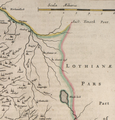
Blaeu - Atlas of Scotland 1654 - GLOTTIANA PRÆFECTVRA INFERIOR - Longriggend.png 1,564 × 1,632; 3.03 MB
-
Burn off the moor - geograph.org.uk - 2449066.jpg 1,024 × 768; 179 KB
-
Colliery remains - geograph.org.uk - 1492621.jpg 640 × 480; 134 KB
-
Colliery waste - geograph.org.uk - 1492627.jpg 640 × 480; 130 KB
-
Dismantled railway, Longriggend - geograph.org.uk - 990771.jpg 640 × 480; 57 KB
-
Drumbow, Heather moor - geograph.org.uk - 2447371.jpg 1,024 × 768; 77 KB
-
East Longrigg, pasture - geograph.org.uk - 2393416.jpg 1,024 × 768; 91 KB
-
Entrance to Longriggend - geograph.org.uk - 3485069.jpg 640 × 447; 48 KB
-
Flooded peat workings - geograph.org.uk - 2449011.jpg 1,600 × 1,200; 317 KB
-
Flooded peat workings - geograph.org.uk - 2449023.jpg 1,024 × 768; 140 KB
-
Forrestfield Road, bog - geograph.org.uk - 2447352.jpg 1,024 × 768; 117 KB
-
Greendykeside, dam - geograph.org.uk - 2449086.jpg 1,024 × 768; 133 KB
-
Greendykeside, rough grazing - geograph.org.uk - 2393521.jpg 1,024 × 768; 72 KB
-
Heather and peat - geograph.org.uk - 2449052.jpg 1,024 × 768; 119 KB
-
Lanarkshire Sheet III.SE 1896 showing Longriggend.png 1,250 × 780; 1.31 MB
-
Line of Dismantled Railway at Longriggend - geograph.org.uk - 147385.jpg 477 × 640; 163 KB
-
Longrigg School (ruin) - geograph.org.uk - 2050137.jpg 1,022 × 805; 207 KB
-
Longriggend Desolation - geograph.org.uk - 402101.jpg 640 × 480; 109 KB
-
Longriggend Desolation - geograph.org.uk - 402114.jpg 640 × 480; 108 KB
-
Longriggend Plantation - geograph.org.uk - 1806699.jpg 1,024 × 626; 148 KB
-
Longriggend, Meadowfield bing - geograph.org.uk - 2393494.jpg 1,024 × 768; 102 KB
-
Longriggend, rough grazing - geograph.org.uk - 2393480.jpg 1,024 × 768; 127 KB
-
Longriggend, track across the moor - geograph.org.uk - 2449056.jpg 1,024 × 768; 135 KB
-
Longrigggend, Telegraph Road - geograph.org.uk - 2449072.jpg 1,024 × 768; 119 KB
-
Main Street, Longriggend - geograph.org.uk - 1492447.jpg 640 × 480; 70 KB
-
Meadowfield Pit - geograph.org.uk - 1396333.jpg 640 × 480; 81 KB
-
Moorland, Avonhead - geograph.org.uk - 1502263.jpg 640 × 480; 123 KB
-
Moss and sign - geograph.org.uk - 2447367.jpg 1,024 × 768; 100 KB
-
Over the muir and far away - geograph.org.uk - 2499465.jpg 1,024 × 768; 93 KB
-
Peat workings, Telegraph Road - geograph.org.uk - 3485076.jpg 640 × 480; 44 KB
-
Peat workings, Telegraph Road - geograph.org.uk - 3485081.jpg 640 × 480; 63 KB
-
Telegraph Road - geograph.org.uk - 1396326.jpg 640 × 480; 64 KB
-
Track, Longriggend - geograph.org.uk - 1492615.jpg 640 × 480; 141 KB
-
West Longrigg, rough grazing - geograph.org.uk - 2393434.jpg 1,024 × 768; 85 KB
-
Young plantation near Drumbow - geograph.org.uk - 2448967.jpg 1,024 × 768; 107 KB


