Category:Longdendale
Jump to navigation
Jump to search
valley in the Peak District, Derbyshire, United Kingdom  | |||||
| Upload media | |||||
| Instance of | |||||
|---|---|---|---|---|---|
| Located in protected area |
| ||||
| Location | High Peak, Derbyshire, East Midlands, England | ||||
 | |||||
Subcategories
This category has the following 8 subcategories, out of 8 total.
B
C
H
M
W
Media in category "Longdendale"
The following 70 files are in this category, out of 70 total.
-
 "Hey Clough" Bottom - geograph.org.uk - 383028.jpg 640 × 480; 102 KB
-
 A water course off Lawrence Edge - geograph.org.uk - 461600.jpg 640 × 480; 116 KB
-
 Arnfield 3301.JPG 3,488 × 2,616; 2.14 MB
-
 Arnfield 3302.JPG 3,488 × 2,616; 2.25 MB
-
 Arnfield 3303.JPG 3,488 × 2,616; 2.1 MB
-
 Arnfield 3312.JPG 3,488 × 2,616; 2.13 MB
-
 Arnfield 3313.JPG 3,488 × 2,616; 2.11 MB
-
 Arnfield 3316.JPG 3,488 × 2,616; 2.11 MB
-
 Arnfield 3318.JPG 3,488 × 2,616; 2.15 MB
-
 Arnfield 3324.JPG 3,488 × 2,616; 2.14 MB
-
 Arnfield 3325.JPG 3,488 × 2,616; 2.17 MB
-
 Arnfield 3326.JPG 3,488 × 2,616; 2.17 MB
-
 Arnfield Clough Sheep 3305.JPG 3,488 × 2,616; 2.07 MB
-
 Arnfield Clough Sheep 3306.JPG 3,488 × 2,616; 2.1 MB
-

-
 Boundary Wall with Rocks - geograph.org.uk - 580357.jpg 640 × 480; 127 KB
-
 Featherbed Moss - geograph.org.uk - 245945.jpg 640 × 480; 155 KB
-
 Hadfield4614.JPG 2,048 × 1,536; 789 KB
-
 Hadfield4615.JPG 2,048 × 1,536; 783 KB
-
 Hadfield4616.JPG 2,048 × 1,536; 833 KB
-
 Hadfield4631.JPG 2,048 × 1,536; 792 KB
-
 Hadfield4745.JPG 2,048 × 1,536; 781 KB
-
 Hadfield4758.JPG 2,048 × 1,536; 775 KB
-
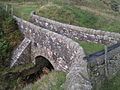 Lady Shaw Bridge, Longdendale, Derbyshire.JPG 2,048 × 1,536; 681 KB
-
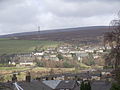
 Longdendale and surrounding area - geograph.org.uk - 5240355.jpg 494 × 640; 51 KB
-
 Longdendale Bypass Map.PNG 885 × 547; 161 KB
-
 Longdendale dusk - geograph.org.uk - 604460.jpg 640 × 398; 20 KB
-
 Longdendale from Woodhead.jpg 2,048 × 1,536; 652 KB
-
 Longdendale looking West.JPG 2,048 × 1,536; 710 KB
-
 Longdendale trail.jpg 640 × 480; 85 KB
-
 Longdendale Urban District, Cheshire (1970).svg 1,410 × 1,018; 385 KB
-
 Longdendale Valley - geograph.org.uk - 511438.jpg 640 × 455; 78 KB
-
 Longdendale4633.JPG 2,048 × 1,536; 763 KB
-
 Longdendale4636.JPG 2,048 × 1,536; 791 KB
-
 Longdendale4642.JPG 2,048 × 1,536; 790 KB
-
 Longdendale4661.JPG 2,048 × 1,536; 766 KB
-
 Longdendale4663.JPG 2,048 × 1,536; 763 KB
-
 Longdendale4714.JPG 2,048 × 1,536; 789 KB
-
 Moorland View - geograph.org.uk - 580274.jpg 640 × 480; 65 KB
-
 Near Black Clough to the A628 - geograph.org.uk - 457304.jpg 640 × 480; 71 KB
-
 Peak District 4533.jpeg 2,048 × 1,536; 894 KB
-
 River Etherow map.png 1,084 × 576; 301 KB
-
-
 Sheep on Longden End Moor - geograph.org.uk - 115386.jpg 640 × 480; 80 KB
-
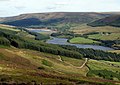
 The Longdendale Valley - geograph.org.uk - 6421145.jpg 3,933 × 2,950; 3.12 MB
-
 Tintwistle 3328.JPG 3,488 × 2,616; 2.2 MB
-
 Tintwistle 3330.JPG 3,488 × 2,616; 2.14 MB
-
 Tintwistle 3331.JPG 2,616 × 3,488; 2.15 MB
-
 Tintwistle 3332.JPG 3,488 × 2,616; 2.02 MB
-
 Tintwistle 3355.JPG 2,616 × 3,488; 2 MB
-
 Tintwistle 3356.JPG 3,488 × 2,616; 2.04 MB
-
 Tintwistle 3358.JPG 3,488 × 2,616; 2.03 MB
-
 Tintwistle 3363.JPG 3,488 × 2,616; 2.15 MB
-
 Tintwistle Bulls Head Pub 3361.JPG 3,488 × 2,616; 2.07 MB
-
 Tintwistle United Reformed Church 3359.JPG 3,488 × 2,616; 2.17 MB
-
 Tintwistle Wesleyan Methodist Chapel3357.JPG 3,488 × 2,616; 2.08 MB
-
 Tintwistle4723.JPG 2,048 × 1,536; 773 KB
-
 Tintwistle4738.JPG 2,048 × 1,536; 797 KB
-
 Torside8485.JPG 2,048 × 1,536; 782 KB
-
 Valve Station To The West Of Bleak House, Woodhead Road, Derbyshire 1.jpg 1,800 × 1,200; 2.46 MB
-
 View towards Longdendale - geograph.org.uk - 1722997.jpg 640 × 480; 118 KB
-
 Woodhead entrance to Woodhead Tunnel.jpg 640 × 480; 132 KB
-
 Woodhead8615.JPG 2,048 × 1,536; 777 KB
-
 Approaching Hollingworth - geograph.org.uk - 994770.jpg 588 × 640; 140 KB
-
 Dewsnap Lane - geograph.org.uk - 766246.jpg 640 × 480; 110 KB
-
 Hobson Moor - geograph.org.uk - 37822.jpg 640 × 480; 120 KB
-
 Hollingworth Hall - geograph.org.uk - 48752.jpg 640 × 480; 117 KB
-
 Junction - geograph.org.uk - 492828.jpg 640 × 480; 86 KB
-
 Landslow Green Farm - geograph.org.uk - 48748.jpg 640 × 480; 116 KB
-
 Staley Hill County Primary School - geograph.org.uk - 37825.jpg 640 × 480; 138 KB


.svg)


