Category:Long Prairie, Minnesota
Jump to navigation
Jump to search
Images and media pertaining to Long Prairie, Minnesota.
city in Todd County, Minnesota, United States of America  Central Avenue  | |||||
| Upload media | |||||
| Instance of | |||||
|---|---|---|---|---|---|
| Location | Todd County, Minnesota | ||||
| Population |
| ||||
| Area |
| ||||
| Elevation above sea level |
| ||||
| official website | |||||
 | |||||
Subcategories
This category has the following 9 subcategories, out of 9 total.
Media in category "Long Prairie, Minnesota"
The following 21 files are in this category, out of 21 total.
-
 Arcade Building, Long Prairie, Minnesota.jpg 4,968 × 3,351; 5.9 MB
-
 Argus Block and First National Bank building, Long Prairie, Minnesota.jpg 3,807 × 2,577; 7.23 MB
-
 Armory building, Long Prairie, Minnesota.jpg 5,096 × 3,183; 5.48 MB
-
 Businesses between Arcade Building and Hart Building, Long Prairie, Minnesota.jpg 5,177 × 3,042; 5.68 MB
-
 Central Avenue at Arcade Building looking SW, Long Prairie, Minnesota.jpg 4,032 × 3,024; 2.18 MB
-
 Central Avenue at Kemp Block and 2nd Street looking SW, Long Prairie, Minnesota.jpg 3,893 × 1,787; 1.27 MB
-
 Central Avenue business-02, Long Prairie, Minnesota.jpg 5,151 × 2,682; 4.51 MB
-
 Central Avenue businesses-01, Long Prairie, Minnesota.jpg 4,992 × 3,066; 4.95 MB
-
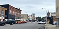 Central Avenue, Long Prairie, Minnesota.jpg 4,032 × 2,020; 1.11 MB
-
 First National Bank Building, Long Prairie, Minnesota.jpg 2,567 × 3,099; 1.73 MB
-
 Hart Block, Central Avenue, Long Prairie, Minnesota.jpg 4,032 × 3,024; 2.41 MB
-
 Hart Building damage, Long Prairie, Minnesota.jpg 5,184 × 3,456; 5.14 MB
-
 Kemp Block building, Long Prairie, Minnesota.jpg 5,184 × 3,456; 6.09 MB
-
 Long Prairie Leader, newspaper building, Long Prairie, Minnesota.jpg 5,184 × 3,456; 6.27 MB
-
 Long Prairie Minnesota.jpg 2,799 × 1,787; 1.04 MB
-
 Main Street Goverment Center & Todd County Museum, Long Prairie, Minnesota.jpg 4,011 × 1,089; 892 KB
-
 Main Street Goverment Center, Long Prairie, Minnesota.jpg 4,032 × 3,024; 1.88 MB
-
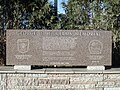 Marshall George H Williams Memorial, Long Prairie, Minnesota.jpg 640 × 480; 147 KB
-
 MNMap-doton-Long Prairie.png 262 × 300; 10 KB
-
 Mosaics at Harmony Park, Long Prairie, MN, USA.jpg 1,984 × 1,488; 632 KB
-
 WPA stone work at Riverside Park, Long Prairie, Minnesota.jpg 640 × 480; 147 KB


