Category:London photographs taken on 2010-10-10
Jump to navigation
Jump to search
Most populous urban areas of the world: London [GB] · Moscow [RU] · Nagoya [JP] · New York City [US] · Singapore [SG]
| Photographs of the previous week | · | Photographs of the previous day | ← | 10 October 2010 | → | Photographs of the next day | · | Photographs of the next week |
| Photographs of the previous year | · | Photographs of the previous month | ← | → | Photographs of the next month | · | Photographs of the next year |
| 3 | · | 4 | · | 5 | · | 6 | · | 7 | · | 8 | · | 9 | · | 10 | · | 11 | · | 12 | · | 13 | · | 14 | · | 15 | · | 16 | · | 17 |

Files or subcategories can be added here using a direct categorization tag. Image files can be categorized here also automatically using {{Taken on}} template.
Media in category "London photographs taken on 2010-10-10"
The following 116 files are in this category, out of 116 total.
-
 113 Cadogan Gardens SW1 - geograph.org.uk - 2105416.jpg 480 × 640; 68 KB
-
 A Tramlink tram (geograph 2160304).jpg 640 × 430; 164 KB
-

-
 Autumn leaves in Greenwich Park - geograph.org.uk - 2104712.jpg 640 × 480; 272 KB
-
 Bankside, South Croydon - geograph.org.uk - 2155120.jpg 640 × 430; 131 KB
-

-

-
 Bibendum Building, Fulham Road SW3 - geograph.org.uk - 2105354.jpg 640 × 479; 62 KB
-

-
 Block of flats, Deptford - geograph.org.uk - 2105638.jpg 480 × 640; 53 KB
-
 Boating lake in Greenwich Park - geograph.org.uk - 2104724.jpg 640 × 480; 110 KB
-
 Bridleway to the B275 - geograph.org.uk - 2156880.jpg 640 × 430; 219 KB
-
 Britten Street SW3 - geograph.org.uk - 2105188.jpg 479 × 640; 96 KB
-
 Brownlow Rd, Croydon - geograph.org.uk - 2161165.jpg 640 × 430; 148 KB
-
 Builders Arms, Britten Street SW3 - geograph.org.uk - 2105181.jpg 464 × 640; 78 KB
-
 Bunker, Croham Hurst Golf Course - geograph.org.uk - 2155208.jpg 640 × 430; 162 KB
-
 Cadogan Gardens SW3 - geograph.org.uk - 2105445.jpg 480 × 640; 83 KB
-

-

-
 Chelsea Cinema, Kings Road SW3 - geograph.org.uk - 2105496.jpg 480 × 640; 72 KB
-
 Chelsea Fire Station, Kings Road SW3 - geograph.org.uk - 2105521.jpg 640 × 480; 116 KB
-
 Chelsea Potter, Radnor Walk SW3 - geograph.org.uk - 2105467.jpg 480 × 640; 60 KB
-

-
 Chelsea Toys, Cale Street SW3 - geograph.org.uk - 2105159.jpg 640 × 478; 58 KB
-
 Chestnut pickers in Greenwich Park - geograph.org.uk - 2104710.jpg 640 × 480; 213 KB
-
 Chestnut tree in Greenwich Park - geograph.org.uk - 2104707.jpg 640 × 480; 205 KB
-

-
 Clubhouse, Oakwood Park, London N14 - geograph.org.uk - 2124895.jpg 1,024 × 768; 430 KB
-
 Croydon flyover - geograph.org.uk - 2164426.jpg 640 × 430; 112 KB
-

-
 Duke of York's Square SW3 - geograph.org.uk - 2105092.jpg 480 × 640; 114 KB
-
 Elystan Street SW3 - geograph.org.uk - 2105128.jpg 480 × 640; 79 KB
-
 Eni House, Ebury Bridge Road SW1 - geograph.org.uk - 2104766.jpg 640 × 480; 64 KB
-

-

-
 Geales Restaurant, Cale Street SW3 - geograph.org.uk - 2105148.jpg 480 × 640; 52 KB
-

-

-
 Jackson, Cadogan Street SW3 - geograph.org.uk - 2105406.jpg 480 × 640; 78 KB
-
 John Lewis, Sloane Square SW1 - geograph.org.uk - 2105054.jpg 640 × 479; 76 KB
-

-
 Joseph, Sloane Avenue SW3 - geograph.org.uk - 2105345.jpg 640 × 469; 66 KB
-
 Killir ^ Co, Cadogan Street SW3 - geograph.org.uk - 2105391.jpg 480 × 640; 76 KB
-
 Kings Road SW10 - geograph.org.uk - 2105585.jpg 640 × 473; 60 KB
-
 Le Poule au Pot, Ebury Street SW1 - geograph.org.uk - 2104844.jpg 480 × 640; 130 KB
-
 Le Suquet, Draycott Place SW3 - geograph.org.uk - 2105375.jpg 475 × 640; 41 KB
-
 Level crossing, Oak Lane (geograph 2160264).jpg 640 × 430; 165 KB
-
 London Wall Street.jpg 2,048 × 1,536; 413 KB
-

-
 Mortlake High Street - geograph.org.uk - 2133902.jpg 640 × 480; 76 KB
-
 Municipal buildings, Croydon (geograph 2164400).jpg 640 × 430; 147 KB
-
 My First HDR Attempt- Rim Planet London (5068668289).jpg 3,333 × 2,424; 5.46 MB
-

-

-

-
-
 Notice board, St Luke's Gardens SW3 - geograph.org.uk - 2105173.jpg 640 × 473; 93 KB
-

-
 Park Walk SW10 - geograph.org.uk - 2105563.jpg 640 × 470; 61 KB
-
 Pimlico Road SW1 - geograph.org.uk - 2104875.jpg 480 × 640; 83 KB
-

-
 Queen's Head, Tryon Street SW3 - geograph.org.uk - 2105108.jpg 640 × 480; 74 KB
-
 RAY 3020.jpg 2,442 × 3,561; 4.3 MB
-
 RAY 3080.jpg 3,463 × 5,335; 8.3 MB
-
 RAY 3133.jpg 3,407 × 3,830; 6.12 MB
-
 RAY 3217.jpg 3,489 × 4,987; 7.74 MB
-
 RAY 3353.jpg 3,351 × 4,291; 6.01 MB
-
 RAY 3441.jpg 1,874 × 2,364; 2.22 MB
-
 RAY 3509.jpg 3,262 × 4,973; 9.57 MB
-
 Rear of Bibendum, Ixworth Place SW3 - geograph.org.uk - 2105305.jpg 640 × 480; 77 KB
-
 Restaurant, Kings Road SW3 - geograph.org.uk - 2105458.jpg 640 × 473; 78 KB
-

-
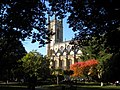
 Royal Brompton Hospital-geograph-2105200.jpg 640 × 471; 64 KB
-

-

-

-

-
 Slaidburn Street SW10 - geograph.org.uk - 2105601.jpg 480 × 640; 61 KB
-

-
 Sloane Terrace SW1 - geograph.org.uk - 2105420.jpg 640 × 480; 70 KB
-
-

-

-
 St Joseph plaque, Cadogan Street SW3 - geograph.org.uk - 2105396.jpg 640 × 480; 76 KB
-

-

-

-
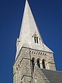
 St Luke's Church, St Luke's Gardens SW3 - geograph.org.uk - 2105079.jpg 640 × 480; 121 KB
-
 St Luke's Church, Sydney Street SW3 - geograph.org.uk - 2105215.jpg 640 × 479; 109 KB
-

-

-
 Street sign, Elystan Place SW3 - geograph.org.uk - 2105114.jpg 640 × 480; 62 KB
-
 Street sign, Ixworth Place SW3 - geograph.org.uk - 2105294.jpg 640 × 480; 68 KB
-
 Street sign, Paulton's Square SW3 - geograph.org.uk - 2105543.jpg 640 × 480; 62 KB
-
 Street sign, Sloane Square SW1 - geograph.org.uk - 2105434.jpg 640 × 480; 63 KB
-
 Sutton Dwellings, Ixworth Place SW3 - geograph.org.uk - 2105276.jpg 470 × 640; 90 KB
-
 Sydney Street SW3 - geograph.org.uk - 2105208.jpg 480 × 640; 108 KB
-
 Sydney Street SW3 - geograph.org.uk - 2105254.jpg 640 × 479; 73 KB
-
 The Blue Bird Garage, Kings Road SW3 - geograph.org.uk - 2105556.jpg 640 × 480; 70 KB
-
 The Cadogan Arms, Kings Road SW3 - geograph.org.uk - 2105536.jpg 640 × 465; 64 KB
-
 The Chelsea Theatre, Kings Road SW10 - geograph.org.uk - 2105595.jpg 640 × 480; 100 KB
-
 The Ebury, Pimlico Road SW1 - geograph.org.uk - 2104786.jpg 480 × 640; 59 KB
-

-
 The Sloane Club, Lower Sloane Street - geograph.org.uk - 2105034.jpg 465 × 640; 56 KB
-
 The Worlds End, Kings Road SW10 - geograph.org.uk - 2105607.jpg 480 × 640; 79 KB
-

-
 Tooting Broadway.jpeg 500 × 375; 67 KB
-
 Trafalgar, Kings Road SW3 - geograph.org.uk - 2105488.jpg 640 × 455; 87 KB
-
 Ulorin Vex (5090545611).jpg 3,503 × 5,121; 7.38 MB
-

-

-
 Walton Street SW3 - geograph.org.uk - 2105361.jpg 640 × 474; 63 KB
-
 War memorial, Croydon (geograph 2164407).jpg 640 × 430; 158 KB
-

-
 World's End Nursery, Kings Road SW10 - geograph.org.uk - 2105576.jpg 480 × 640; 98 KB
-
 Zampa Road, SE16 - geograph.org.uk - 2105529.jpg 640 × 480; 92 KB

.jpg)


,_Fulham_Road_SW3_-_geograph.org.uk_-_2105316.jpg)


.jpg)


.jpg)
.jpg)


.jpg)


.jpg)


