Category:Locator maps of wards in Bristol
Jump to navigation
Jump to search
Media in category "Locator maps of wards in Bristol"
The following 71 files are in this category, out of 71 total.
-
Ashley Bristol UK ward map.svg 1,138 × 1,266; 709 KB
-
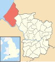
Avonmouth Bristol UK ward map.svg 1,138 × 1,266; 709 KB
-
Bedminster Bristol UK ward map.svg 1,138 × 1,266; 709 KB
-
Bishopston Bristol UK ward map.svg 1,138 × 1,266; 709 KB
-
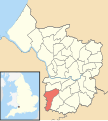
Bishopsworth Bristol UK ward map.svg 1,138 × 1,266; 709 KB
-
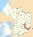
Brislington East Bristol UK ward map.svg 1,138 × 1,266; 709 KB
-
Brislington West Bristol UK ward map.svg 1,138 × 1,266; 709 KB
-
Bristol ashley.png 702 × 780; 148 KB
-
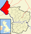
Bristol avonmouth.png 702 × 780; 144 KB
-
Bristol bedminster.png 702 × 780; 148 KB
-
Bristol bishopston.png 702 × 780; 149 KB
-
Bristol bishopsworth.png 702 × 780; 148 KB
-
Bristol brislington.png 702 × 780; 149 KB
-
Bristol cabot.png 702 × 780; 149 KB
-
Bristol clifton.png 702 × 780; 149 KB
-
Bristol cotham.png 702 × 780; 145 KB
-
Bristol easton.png 702 × 780; 148 KB
-
Bristol eastville.png 702 × 780; 148 KB
-
Bristol filwood.png 702 × 780; 145 KB
-
Bristol frome.png 702 × 780; 148 KB
-
Bristol hartcliffe.png 702 × 780; 149 KB
-
Bristol henbury.png 702 × 780; 148 KB
-
Bristol hengrove.png 702 × 780; 149 KB
-
Bristol henleaze.png 702 × 780; 145 KB
-
Bristol hillfields.png 702 × 780; 148 KB
-
Bristol horfield.png 702 × 780; 148 KB
-
Bristol knowle.png 702 × 780; 149 KB
-
Bristol lawrencehill.png 702 × 780; 149 KB
-
Bristol lockleaze.png 702 × 780; 148 KB
-
Bristol redland.png 702 × 780; 145 KB
-
Bristol southmead.png 702 × 780; 148 KB
-
Bristol southville.png 702 × 780; 148 KB
-
Bristol stgeorge.png 702 × 780; 148 KB
-
Bristol stgeorgewest.png 702 × 780; 152 KB
-
Bristol stockwood.png 702 × 780; 148 KB
-
Bristol stokebishop.png 702 × 780; 149 KB
-
Bristol ward map (1983 to 1999).png 745 × 841; 199 KB
-
Bristol ward map (1999 to 2016).png 745 × 841; 206 KB
-
Bristol ward map (2016 onwards).png 745 × 841; 198 KB
-
Bristol wards 1983 to 1999.png 880 × 980; 168 KB
-
Bristol westbury.png 702 × 780; 145 KB
-
Bristol whitchurchpark.png 702 × 780; 148 KB
-
Bristol windmillhill.png 702 × 780; 148 KB
-
Cabot Bristol UK ward map.svg 1,138 × 1,266; 709 KB
-
Clifton Bristol UK ward map.svg 1,138 × 1,266; 709 KB
-
Clifton East Bristol UK ward map.svg 1,138 × 1,266; 709 KB
-
Cotham Bristol UK ward map.svg 1,138 × 1,266; 709 KB
-
Easton Bristol UK ward map.svg 1,138 × 1,266; 709 KB
-
Eastville Bristol UK ward map.svg 1,138 × 1,266; 709 KB
-
Filwood Bristol UK ward map.svg 1,138 × 1,266; 709 KB
-
Frome Vale Bristol UK ward map.svg 1,138 × 1,266; 709 KB
-
Hartcliffe Bristol UK ward map.svg 1,138 × 1,266; 709 KB
-
Henbury Bristol UK ward map.svg 1,138 × 1,266; 709 KB
-
Hengrove Bristol UK ward map.svg 1,138 × 1,266; 709 KB
-
Henleaze Bristol UK ward map.svg 1,138 × 1,266; 709 KB
-
Hillfields Bristol UK ward map.svg 1,138 × 1,266; 709 KB
-
Horfield Bristol UK ward map.svg 1,138 × 1,266; 709 KB
-
Kingsweston Bristol UK ward map.svg 1,138 × 1,266; 709 KB
-
Knowle Bristol UK ward map.svg 1,138 × 1,266; 709 KB
-
Lawrence Hill Bristol UK ward map.svg 1,138 × 1,266; 709 KB
-
Lockleaze Bristol UK ward map.svg 1,138 × 1,266; 709 KB
-
Redland Bristol UK ward map.svg 1,138 × 1,266; 709 KB
-
Southmead Bristol UK ward map.svg 1,138 × 1,266; 709 KB
-
Southville Bristol UK ward map.svg 1,138 × 1,266; 709 KB
-
St George East Bristol UK ward map.svg 1,138 × 1,266; 709 KB
-
St George West Bristol UK ward map.svg 1,138 × 1,266; 709 KB
-
Stockwood Bristol UK ward map.svg 1,138 × 1,266; 709 KB
-
Stoke Bishop Bristol UK ward map.svg 1,138 × 1,266; 709 KB
-
Westbury-on-Trym Bristol UK ward map.svg 1,138 × 1,266; 709 KB
-
Whitchurch Park Bristol UK ward map.svg 1,138 × 1,266; 709 KB
-
Windmill Hill Bristol UK ward map.svg 1,138 × 1,266; 709 KB

