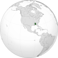
Category:Locator maps of the Confederate States
Jump to navigation
Jump to search
Subcategories
This category has only the following subcategory.
Media in category "Locator maps of the Confederate States"
The following 13 files are in this category, out of 13 total.
-
Abconfederateabc.png 800 × 800; 183 KB
-
Alabama (1861) orthographic.svg 551 × 551; 2.31 MB
-
Confederacy.png 1,357 × 628; 38 KB
-
Confederate States map 1861-12-31 to 1865-05-05 (cropped).png 2,000 × 1,007; 314 KB
-
Confederate States of America (orthographic projection).svg 551 × 551; 2.34 MB
-
CSAlocation.png 250 × 115; 6 KB
-
Florida (1861) orthographic.svg 551 × 551; 2.3 MB
-
Georgia (1861) orthographic.svg 551 × 551; 2.31 MB
-
LocationWHConfederateStatesofAmerica.png 800 × 800; 32 KB
-
Louisiana (1861) orthographic.svg 551 × 551; 2.31 MB
-
Mississippi (1861) orthographic.svg 551 × 551; 2.29 MB
-
South Carolina (1860) orthographic.svg 551 × 551; 2.28 MB
-
Texas (1861) orthographic.svg 551 × 551; 2.33 MB


