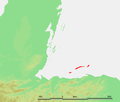
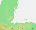
Category:Locator maps of the Bay Islands of Honduras
Jump to navigation
Jump to search
Media in category "Locator maps of the Bay Islands of Honduras"
The following 6 files are in this category, out of 6 total.
-
Bay Islands detail.PNG 566 × 483; 39 KB
-
Bay Islands - Útila.PNG 566 × 483; 39 KB
-
Bay Islands.PNG 636 × 445; 174 KB
-
Bay Islands - Guanaja.PNG 566 × 483; 39 KB
-
Honduras-Islas de la Bahia.png 200 × 118; 3 KB
-
Bay Islands - Roatan.PNG 566 × 483; 39 KB


