Category:Locator maps of subdivisions of Scotland
Jump to navigation
Jump to search
Constituent countries of the United Kingdom: Scotland
| NO WIKIDATA ID FOUND! Search for Locator maps of subdivisions of Scotland on Wikidata | |
| Upload media |
Subcategories
This category has the following 2 subcategories, out of 2 total.
Media in category "Locator maps of subdivisions of Scotland"
The following 66 files are in this category, out of 66 total.
-
Aberdeen map.png 220 × 326; 8 KB
-
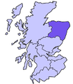
Aberdeenshire council map.png 220 × 326; 8 KB
-
Angus council map.png 220 × 326; 8 KB
-
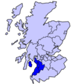
Argyll and Bute council map.png 220 × 326; 8 KB
-
Argyll and Bute, East Dunbartonshire, West Dunbartonshire 1999.svg 596 × 747; 820 KB
-
Ayrshire and Arran.png 200 × 229; 24 KB
-
Borders Location.png 400 × 457; 64 KB
-
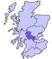
Central Scotland Location.png 400 × 457; 63 KB
-
City of Edinburgh 2011.svg 599 × 746; 809 KB
-
Clackmannanshire, Stirling 1999.svg 596 × 747; 820 KB
-
Clackmannanshire, Stirling 2011.svg 599 × 746; 809 KB
-
Clackmannanshire, Stirling.svg 603 × 753; 671 KB
-
Cunninghame.png 191 × 261; 3 KB
-
Division of Brand 2021 Map.svg 875 × 1,250; 353 KB
-
Division of Burt 2021 Map.svg 875 × 1,250; 353 KB
-
Division of Cowan 2021 Map.svg 875 × 1,250; 353 KB
-
Division of Curtin 2021 Map.svg 875 × 1,250; 353 KB
-
Division of Fremantle 2021 Map.svg 875 × 1,250; 353 KB
-
Division of Hasluck 2021 Map.svg 875 × 1,250; 353 KB
-
Division of Moore 2021 Map.svg 875 × 1,250; 353 KB
-
Division of Pearce 2021 Map.svg 875 × 1,250; 353 KB
-
Division of Perth 2021 Map.svg 875 × 1,250; 353 KB
-
Division of Swan 2021 Map.svg 875 × 1,250; 353 KB
-
Division of Tangney 2021 Map.svg 875 × 1,250; 353 KB
-
Dumfries e Galloway locazione.png 400 × 457; 64 KB
-
Dundee 1999.svg 596 × 747; 820 KB
-
East Dunbartonshire map.png 220 × 326; 8 KB
-
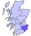
East Lothian, Midlothian, Scottish Borders 1999.svg 596 × 747; 820 KB
-
East Lothian, Midlothian, Scottish Borders 2011.svg 599 × 746; 809 KB
-
East Renfrewshire, Inverclyde, Renfrewshire 2011.svg 599 × 746; 809 KB
-
East Renfrewshire, Inverclyde, Renfrewshire.svg 603 × 753; 671 KB
-
Falkirk 1999.svg 596 × 747; 820 KB
-
Falkirk 2011.svg 599 × 746; 809 KB
-
Falkirk council area.svg 603 × 753; 671 KB
-
Fife 1999.svg 596 × 747; 820 KB
-
Fife 2011.svg 599 × 746; 809 KB
-
Fife council area.svg 603 × 753; 675 KB
-
Fife location.png 400 × 457; 66 KB
-
Glasgow and Clyde Valley City Region.svg 603 × 753; 675 KB
-
Glasgow City.svg 603 × 753; 671 KB
-
Gowrie.png 191 × 261; 3 KB
-
Grampian location.png 400 × 457; 65 KB
-
Highland 2011.svg 599 × 746; 809 KB
-
Highland council.svg 603 × 753; 671 KB
-
Inner Hebrides.png 2,733 × 3,411; 212 KB
-
Linn ward.PNG 418 × 342; 11 KB
-
Lothian location.png 400 × 457; 65 KB
-
Na h-Eileanan an Iar council area.svg 603 × 753; 679 KB
-
Na h-Eileanan Siar 2011.svg 599 × 746; 809 KB
-
NHSforthvalley.png 2,733 × 3,411; 218 KB
-
North Ayrshire council area.svg 603 × 753; 675 KB
-
North Lanarkshire, South Lanarkshire 1999.svg 596 × 747; 820 KB
-
North Lanarkshire, South Lanarkshire 2011.svg 599 × 746; 809 KB
-
Scotland location map - Central Belt.png 684 × 899; 150 KB
-
ScotlandAberdeenshireBanffBuchan.png 191 × 261; 4 KB
-
ScotlandAngus.png 200 × 230; 4 KB
-
ScotlandCaithnessTrad.png 200 × 229; 32 KB
-
ScotlandCentral1974.png 200 × 229; 23 KB
-
ScotlandDunbartonshireLieut.png 200 × 229; 30 KB
-
ScotlandGrampians1974.png 200 × 229; 23 KB
-
ScotlandInvernessLieut.png 200 × 229; 23 KB
-
ScotlandLothian1974.png 200 × 229; 23 KB
-
ScotlandTayside1974.png 200 × 229; 23 KB
-
Strathclyde Location in Scotland.png 400 × 457; 65 KB
-
Tayside Location.png 400 × 457; 66 KB
-
West Lothian 1999.svg 596 × 747; 820 KB


