Category:Locator maps of regions of France (orange scheme)
Jump to navigation
Jump to search
- Warning: This style have been supersed by category: SVG locator maps of regions in France (bright red location map scheme)
Media in category "Locator maps of regions of France (orange scheme)"
The following 23 files are in this category, out of 23 total.
-
 Alsace map.png 200 × 189; 29 KB
-
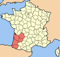 Aquitaine map.png 200 × 189; 29 KB
-
 Auvergne map.png 200 × 189; 29 KB
-
 Basse-Normandie map.png 200 × 189; 29 KB
-
 Bourgogne map.png 200 × 189; 29 KB
-
 Bretagne and PdL.map.png 200 × 189; 28 KB
-
 Centre-Val de Loire map.png 200 × 189; 29 KB
-
 Champagne-Ardenne map.png 200 × 189; 29 KB
-
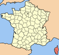 Corse map.png 200 × 189; 18 KB
-
 Franche-Comté map.png 200 × 189; 29 KB
-
 Haute-Normandie map.png 200 × 189; 29 KB
-
 Languedoc-Roussillon map.png 200 × 189; 29 KB
-
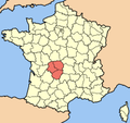 Limousin map.png 200 × 189; 29 KB
-
 Lorraine map.png 200 × 189; 29 KB
-
 Midi-Pyrénées map.png 200 × 189; 28 KB
-
 Nord-Pas-de-Calais map.png 200 × 189; 29 KB
-
 Pays de la Loire map.png 200 × 189; 29 KB
-
 Picardie map.png 200 × 189; 29 KB
-
 Poitou-Charentes map.png 200 × 189; 29 KB
-
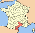
 Provence-Alpes-Côte d’Azur map.png 200 × 189; 29 KB
-

-
 Rhône-Alpes map.png 200 × 189; 29 KB
-
 Île-de-France map.png 200 × 189; 29 KB


