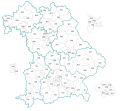
Category:Locator maps of parliamentary constituencies of Bavaria
Jump to navigation
Jump to search
Federal states of Germany:
Main categories: Locator maps of parliamentary constituencies of Germany and Election maps of Bavaria
Deutsch: Lagekarten von Wahlkreisen in Bayern
Media in category "Locator maps of parliamentary constituencies of Bavaria"
The following 4 files are in this category, out of 4 total.
-
Bayern Landtagswahlkreise 2013.svg 772 × 708; 2.05 MB
-
Bayern Landtagswahlkreise 2018.svg 772 × 708; 2 MB
-
München -- Karte der Stimmkreise bei der Landtagswahl 2008.svg 811 × 566; 124 KB
-
München -- Karte der Stimmkreise bei der Landtagswahl 2018.svg 810 × 565; 33 KB


