Category:Locator maps of neighborhoods of Rio de Janeiro (city)
Jump to navigation
Jump to search
Capitals of Brazil: Aracaju · Belém · Belo Horizonte · Boa Vista · Brasília · Campo Grande · Cuiabá · Curitiba · Florianópolis · Fortaleza · Goiânia · João Pessoa · Macapá · Maceió · Manaus · Natal · Palmas · Porto Alegre · Porto Velho · Recife · Rio Branco · Rio de Janeiro · Salvador · São Luís · São Paulo · Teresina · Vitória ·
Media in category "Locator maps of neighborhoods of Rio de Janeiro (city)"
The following 149 files are in this category, out of 149 total.
-
 Map of Rio de Janeiro city (East side).svg 1,924 × 1,030; 15.79 MB
-
 Location map Rio de Janeiro Centro.png 923 × 977; 563 KB
-
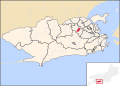
 Abolição.svg 956 × 685; 568 KB
-
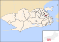
 Acari.svg 956 × 685; 573 KB
-
 Alto da Boa Vista.svg 956 × 685; 573 KB
-
 Anchieta.svg 956 × 685; 573 KB
-
 Andaraí.svg 956 × 685; 573 KB
-
 Botafogo Rio de Janeiro Map.png 800 × 576; 164 KB
-
 Bairro Bonsucesso.svg 956 × 685; 573 KB
-
 Bairro Centro.svg 956 × 685; 573 KB
-
 Barra da Tijuca.svg 956 × 685; 573 KB
-
 Barra de Guaratiba.svg 956 × 685; 512 KB
-
 Barros Filho.svg 956 × 685; 573 KB
-
 Benfica.svg 956 × 685; 573 KB
-
 Bento Ribeiro.svg 956 × 685; 573 KB
-
 Botafogo.svg 956 × 685; 573 KB
-
 Brás de Pina.svg 956 × 685; 573 KB
-
 Cachambi.svg 956 × 685; 568 KB
-
 Cacuia.svg 956 × 685; 573 KB
-
 Caju.svg 956 × 685; 573 KB
-
 Camorim.svg 956 × 685; 512 KB
-
 Campinho.svg 956 × 685; 568 KB
-
 Cascadura.svg 956 × 685; 568 KB
-
 Catete.svg 956 × 685; 573 KB
-
 Catumbi.svg 956 × 685; 573 KB
-
 Cavalcante.svg 956 × 685; 568 KB
-
 Centro.svg 956 × 685; 574 KB
-
 Cidade de Deus.svg 956 × 685; 512 KB
-
 Cidade Nova.svg 956 × 685; 573 KB
-
 Cidade Universitária.svg 956 × 685; 573 KB
-
 Cocotá.svg 956 × 685; 573 KB
-
 Coelho Neto.svg 956 × 685; 573 KB
-
 Colégio.svg 956 × 685; 568 KB
-
 Location map Rio de Janeiro Copacabana.png 1,846 × 1,954; 971 KB
-
 Copacabana.svg 956 × 685; 573 KB
-
 Cordovil.svg 956 × 685; 573 KB
-
 Cosme Velho.svg 956 × 685; 573 KB
-
 Costa Barros.svg 956 × 685; 573 KB
-
 Del Castilho.svg 956 × 685; 573 KB
-
 Deodoro.svg 956 × 685; 512 KB
-
 Encantado.svg 956 × 685; 568 KB
-
 Engenheiro Leal.svg 956 × 685; 568 KB
-
 Engenho da Rainha.svg 956 × 685; 568 KB
-
 Engenho de Dentro.svg 956 × 685; 568 KB
-
 Engenho Novo.svg 956 × 685; 568 KB
-
 Estácio.svg 956 × 685; 573 KB
-
 Flamengo.svg 956 × 685; 573 KB
-
 Freguesia.svg 956 × 685; 573 KB
-
 Galeão.svg 956 × 685; 573 KB
-
 Gamboa.svg 956 × 685; 573 KB
-
 Glória.svg 956 × 685; 573 KB
-
 Grajaú.svg 956 × 685; 573 KB
-
 Guadalupe.svg 956 × 685; 573 KB
-
 Guaratiba.svg 956 × 685; 512 KB
-
 Gávea.svg 956 × 685; 573 KB
-
 Higienópolis.svg 956 × 685; 568 KB
-
 Honório Gurgel.svg 956 × 685; 573 KB
-
 Humaitá.svg 956 × 685; 573 KB
-
 Inhaúma.svg 956 × 685; 573 KB
-
 Ipanema.svg 956 × 685; 573 KB
-
 Irajá.svg 956 × 685; 568 KB
-
 Itanhanga.svg 956 × 685; 512 KB
-
 Jacarezinho locator map.svg 956 × 685; 516 KB
-
 Jacaré.svg 956 × 685; 573 KB
-
 Jardim América.svg 956 × 685; 573 KB
-
 Jardim Botânico.svg 956 × 685; 573 KB
-
 Jardim Carioca.svg 956 × 685; 573 KB
-
 Jardim Guanabara.svg 956 × 685; 573 KB
-
 Joa.svg 956 × 685; 512 KB
-
 Lagoa.svg 956 × 685; 573 KB
-
 Lapa.svg 956 × 685; 574 KB
-
 Laranjeiras.svg 956 × 685; 573 KB
-
 Leblon.svg 956 × 685; 573 KB
-
 Leme.svg 956 × 685; 573 KB
-
 Lins de Vasconcelos.svg 956 × 685; 568 KB
-
 Madureira.svg 956 × 685; 568 KB
-
 Magalhaes Bastos.svg 956 × 685; 512 KB
-
 Mangueira.svg 956 × 685; 573 KB
-
 Manguinhos.svg 956 × 685; 573 KB
-
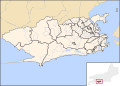
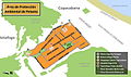
 Map of Rio de Janeiro city Administrative Regions.svg 956 × 685; 576 KB
-
 Map of Rio de Janeiro city neighbourhoods.svg 956 × 685; 576 KB
-
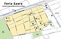 Mapa de feria Saara.jpg 1,317 × 848; 182 KB
-
 Mapa de Leblon.jpg 1,395 × 994; 192 KB
-
 Mapa Peixoto.jpg 1,559 × 925; 207 KB
-
 Mapalaranjeiras.jpg 374 × 561; 131 KB
-
 Maracanã.svg 956 × 685; 573 KB
-
 Marechal Hermes.svg 956 × 685; 573 KB
-
 Maria da Graça.svg 956 × 685; 573 KB
-
 Moneró.svg 956 × 685; 573 KB
-
 Morro dos Prazeres (RJ) - Map.png 815 × 543; 465 KB
-
 Méier.svg 956 × 685; 568 KB
-
 Olaria.svg 956 × 685; 573 KB
-
 Oswaldo Cruz.svg 956 × 685; 573 KB
-
 Paciencia.svg 956 × 685; 512 KB
-
 Paquetá.svg 956 × 685; 573 KB
-
 Parada de Lucas.svg 956 × 685; 573 KB
-
 Parque Anchieta.svg 956 × 685; 573 KB
-
 Pavuna.svg 956 × 685; 573 KB
-
 Pedra de Guaratiba.svg 956 × 685; 512 KB
-
 Penha Circular.svg 956 × 685; 573 KB
-
 Penha.svg 956 × 685; 573 KB
-
 Piedade.svg 956 × 685; 568 KB
-
 Pilares.svg 956 × 685; 568 KB
-
 Pitangueiras.svg 956 × 685; 573 KB
-
 Portuguesa.svg 956 × 685; 573 KB
-
 Praia da Bandeira.svg 956 × 685; 573 KB
-
 Praça da Bandeira.svg 956 × 685; 573 KB
-
 Quintino Bocaiúva.svg 956 × 685; 568 KB
-
 Ramos.svg 956 × 685; 573 KB
-
 Realengo.svg 956 × 685; 512 KB
-
 Recreio dos Bandeirantes.svg 956 × 685; 512 KB
-
 Riachuelo.svg 956 × 685; 568 KB
-
 Ribeira.svg 956 × 685; 573 KB
-
 Ricardo de Albuquerque.svg 956 × 685; 573 KB
-
 Rio Comprido.svg 956 × 685; 573 KB
-
 Rocha Miranda.svg 956 × 685; 573 KB
-
 Rocha.svg 956 × 685; 568 KB
-
 Rocinha.svg 956 × 685; 573 KB
-
 Sampaio.svg 956 × 685; 568 KB
-
 Santa Cruz.svg 956 × 685; 574 KB
-
 Santa Teresa.svg 956 × 685; 573 KB
-
 Santo Cristo.svg 956 × 685; 573 KB
-
 Sepetiba.svg 956 × 685; 512 KB
-
 São Conrado.svg 956 × 685; 573 KB
-
 São Cristóvão.svg 956 × 685; 573 KB
-
 São Francisco Xavier.svg 956 × 685; 568 KB
-
 Tauá.svg 956 × 685; 573 KB
-
 Tijuca.svg 956 × 685; 573 KB
-
 Todos os Santos.svg 956 × 685; 568 KB
-
 Tomás Coelho.svg 956 × 685; 568 KB
-
 Turiaçu.svg 956 × 685; 573 KB
-
 Urca.svg 956 × 685; 573 KB
-
 Vargem Grande.svg 956 × 685; 512 KB
-
 Vargem Pequena.svg 956 × 685; 512 KB
-
 Vasco da Gama.svg 956 × 685; 573 KB
-
 Vaz Lobo.svg 956 × 685; 573 KB
-
 Vicente de Carvalho.svg 956 × 685; 568 KB
-
 Vidigal.svg 956 × 685; 568 KB
-
 Vigário Geral.svg 956 × 685; 568 KB
-
 Vila da Penha.svg 956 × 685; 568 KB
-
 Vila Isabel.svg 956 × 685; 573 KB
-
 Vila Kosmos.svg 956 × 685; 568 KB
-
 Vila Militar.svg 956 × 685; 512 KB
-
 Vista Alegre.svg 956 × 685; 568 KB
-
 Zona Central Location map.png 1,019 × 730; 184 KB
-
 Zona Sur de Rio de Janeiro.jpg 1,231 × 939; 170 KB
-
 Municipio Rio de Janeiro.png 873 × 469; 57 KB
-
 Zumbi.svg 956 × 685; 573 KB
-
 Água Santa.svg 956 × 685; 568 KB
.svg)


_-_Map.png)


