Category:Locator maps of neighborhoods in Venlo
Jump to navigation
Jump to search
Subcategories
This category has only the following subcategory.
Media in category "Locator maps of neighborhoods in Venlo"
The following 83 files are in this category, out of 83 total.
-
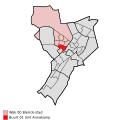
Map - NL - Venlo - Wijk 00 Blerick-stad - Buurt 01 Sint Annakamp.svg 375 × 375; 30 KB
-
Map - NL - Venlo - Wijk 00 Blerick-stad - Buurt 02 Hazenkamp.svg 375 × 375; 30 KB
-
Map - NL - Venlo - Wijk 00 Blerick-stad - Buurt 04 Ubroek.svg 375 × 375; 30 KB
-
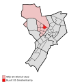
Map - NL - Venlo - Wijk 00 Blerick-stad - Buurt 05 Smelienkamp.svg 375 × 375; 30 KB
-
Map - NL - Venlo - Wijk 00 Blerick-stad - Buurt 06 Vossener.svg 375 × 375; 30 KB
-
Map - NL - Venlo - Wijk 00 Blerick-stad - Buurt 07 Meuleveld.svg 375 × 375; 30 KB
-
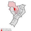
Map - NL - Venlo - Wijk 00 Blerick-stad - Buurt 08 Klingerberg.svg 375 × 375; 30 KB
-
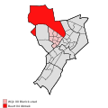
Map - NL - Venlo - Wijk 00 Blerick-stad.svg 625 × 575; 11 KB
-
Map - NL - Venlo - Wijk 01 Venlo-stad - Buurt 00 Centrum-Venlo.svg 375 × 375; 30 KB
-
Map - NL - Venlo - Wijk 01 Venlo-stad - Buurt 01 Hogekamp.svg 375 × 375; 30 KB
-
Map - NL - Venlo - Wijk 01 Venlo-stad - Buurt 02 Leutherberg.svg 375 × 375; 30 KB
-
Map - NL - Venlo - Wijk 01 Venlo-stad - Buurt 03 Vogelhut.svg 375 × 375; 30 KB
-
Map - NL - Venlo - Wijk 01 Venlo-stad - Buurt 04 Genooi.svg 375 × 375; 30 KB
-
Map - NL - Venlo - Wijk 01 Venlo-stad - Buurt 05 Meeuwbeemd.svg 375 × 375; 30 KB
-
Map - NL - Venlo - Wijk 01 Venlo-stad - Buurt 06 Stalberg.svg 375 × 375; 30 KB
-
Map - NL - Venlo - Wijk 01 Venlo-stad - Buurt 07 Sinselveld.svg 375 × 375; 30 KB
-
Map - NL - Venlo - Wijk 01 Venlo-stad - Buurt 08 Hagerhof.svg 375 × 375; 30 KB
-
Map - NL - Venlo - Wijk 01 Venlo-stad - Buurt 09 Hagerbroek.svg 375 × 375; 30 KB
-
Map - NL - Venlo - Wijk 01 Venlo-stad.svg 625 × 575; 11 KB
-
Map - NL - Venlo - Wijk 02 Blerick-randgebied - Buurt 01 Boekend.svg 375 × 375; 30 KB
-
Map - NL - Venlo - Wijk 02 Blerick-randgebied.svg 625 × 575; 11 KB
-
Map - NL - Venlo - Wijk 03 Venlo-randgebied - Buurt 00 Veegtes.svg 375 × 375; 30 KB
-
Map - NL - Venlo - Wijk 03 Venlo-randgebied - Buurt 01 Het Ven.svg 375 × 375; 30 KB
-
Map - NL - Venlo - Wijk 03 Venlo-randgebied - Buurt 03 Venkoelen.svg 375 × 375; 30 KB
-
Map - NL - Venlo - Wijk 03 Venlo-randgebied - Buurt 06 Wijlrehof.svg 375 × 375; 30 KB
-
Map - NL - Venlo - Wijk 03 Venlo-randgebied.svg 625 × 575; 11 KB
-
Map - NL - Venlo - Wijk 04 Tegelen - Buurt 00 Centrum-Tegelen.svg 375 × 375; 30 KB
-
Map - NL - Venlo - Wijk 04 Tegelen - Buurt 01 Oud-Steyl.svg 375 × 375; 30 KB
-
Map - NL - Venlo - Wijk 04 Tegelen - Buurt 02 Windhond.svg 375 × 375; 30 KB
-
Map - NL - Venlo - Wijk 04 Tegelen - Buurt 04 Op de Heide.svg 375 × 375; 30 KB
-
Map - NL - Venlo - Wijk 04 Tegelen - Buurt 05 Nieuw-Steyl.svg 375 × 375; 30 KB
-
Map - NL - Venlo - Wijk 04 Tegelen.svg 625 × 575; 11 KB
-
Map - NL - Venlo - Wijk 05 Geloo-Belfeld - Buurt 00 Geloo.svg 375 × 375; 30 KB
-
Map - NL - Venlo - Wijk 05 Geloo-Belfeld - Buurt 01 Belfeld.svg 375 × 375; 30 KB
-
Map - NL - Venlo - Wijk 05 Geloo-Belfeld.svg 625 × 575; 11 KB
-
Map VenloNL Blerick wijken.PNG 255 × 325; 6 KB
-
Map VenloNL Bloemenbuurt.PNG 425 × 599; 82 KB
-
Map VenloNL Boekend.PNG 425 × 599; 82 KB
-
Map VenloNL GBelfeld.PNG 425 × 599; 69 KB
-
Map VenloNL GBlerick.PNG 451 × 636; 18 KB
-
Map VenloNL Geloo.PNG 425 × 599; 82 KB
-
Map VenloNL Genooi.PNG 425 × 599; 82 KB
-
Map VenloNL Groenveld.PNG 425 × 599; 82 KB
-
Map VenloNL Hazenkamp.PNG 425 × 599; 82 KB
-
Map VenloNL Herongerberg.PNG 425 × 599; 82 KB
-
Map VenloNL HetVen.PNG 425 × 599; 72 KB
-
Map VenloNL Hout-Blerick.PNG 425 × 599; 82 KB
-
Map VenloNL Jammerdaal.PNG 425 × 599; 82 KB
-
Map VenloNL Klingerberg.PNG 425 × 599; 82 KB
-
Map VenloNL Kwadrant1.PNG 425 × 599; 82 KB
-
Map VenloNL Kwadrant2.PNG 425 × 599; 82 KB
-
Map VenloNL Kwadrant3.PNG 425 × 599; 82 KB
-
Map VenloNL Kwadrant4.PNG 425 × 599; 82 KB
-
Map VenloNL Leutherberg.PNG 425 × 599; 72 KB
-
Map VenloNL Meeuwbeemd.PNG 425 × 599; 82 KB
-
Map VenloNL Molenbossen.PNG 425 × 599; 82 KB
-
Map VenloNL Nieuw-Steyl.png 425 × 599; 64 KB
-
Map VenloNL Op de Heide.PNG 425 × 599; 82 KB
-
Map VenloNL Sint Josephparochie.PNG 425 × 599; 64 KB
-
Map VenloNL Smelienkamp.PNG 425 × 599; 82 KB
-
Map VenloNL St AnnaKamp.PNG 425 × 599; 82 KB
-
Map VenloNL Stalberg.PNG 425 × 599; 81 KB
-
Map VenloNL Steyl.PNG 425 × 599; 82 KB
-
Map VenloNL Ubroek.PNG 425 × 599; 83 KB
-
Map VenloNL Vastenavondkamp.PNG 425 × 599; 82 KB
-
Map VenloNL Venkoelen.PNG 425 × 599; 72 KB
-
Map VenloNL Venlo.PNG 451 × 636; 10 KB
-
Map VenloNL Vinckenbosje.PNG 425 × 599; 72 KB
-
Map VenloNL Vossener.PNG 425 × 599; 82 KB
-
Map VenloNL Wijlrehof.PNG 425 × 599; 82 KB
-
Map VenloNL Windhond.PNG 425 × 599; 82 KB
-
Map VenloNL Zonneveld.PNG 425 × 599; 82 KB
-
Venlo CBS 2017 Arcen.png 412 × 964; 26 KB
-
Venlo CBS 2017 Ubroek.png 412 × 964; 26 KB

