Category:Locator maps of neighborhoods in Indianapolis
Jump to navigation
Jump to search
- 100 most populous cities of the United States
- 1–25
- Indianapolis
- Washington, D.C.
- 26–50
- Minneapolis
- 51–75
- Pittsburgh
- 76–100
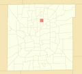
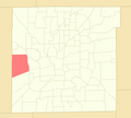
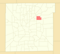
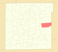
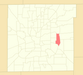
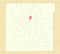
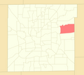
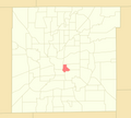
This category contains locator maps for Indianapolis' neighborhood areas.
Media in category "Locator maps of neighborhoods in Indianapolis"
The following 101 files are in this category, out of 101 total.
-
Cottage Home Map.png 1,061 × 825; 525 KB
-
Indianapolis Neighborhood Areas - Acton.png 4,750 × 4,269; 221 KB
-
Indianapolis Neighborhood Areas - Airport.png 4,750 × 4,269; 221 KB
-
Indianapolis Neighborhood Areas - Allisonville.png 4,750 × 4,269; 221 KB
-
Indianapolis Neighborhood Areas - Ameriplex.png 4,750 × 4,269; 221 KB
-
Indianapolis Neighborhood Areas - Arlington Woods.png 4,750 × 4,269; 221 KB
-
Indianapolis Neighborhood Areas - Augusta-New Augusta.png 4,750 × 4,269; 221 KB
-
Indianapolis Neighborhood Areas - Beech Grove.png 4,750 × 4,269; 222 KB
-
Indianapolis Neighborhood Areas - Brendonwood.png 4,750 × 4,269; 221 KB
-
Indianapolis Neighborhood Areas - Broad Ripple.png 4,750 × 4,269; 221 KB
-
Indianapolis Neighborhood Areas - Butler-Tarkington - Rocky Ripple.png 4,750 × 4,269; 221 KB
-
Indianapolis Neighborhood Areas - Camby.png 4,750 × 4,269; 221 KB
-
Indianapolis Neighborhood Areas - Canterbury-Chatard.png 4,750 × 4,269; 220 KB
-
Indianapolis Neighborhood Areas - Castleton.png 4,750 × 4,269; 221 KB
-
Indianapolis Neighborhood Areas - Chapel Hill-Ben Davis.png 4,750 × 4,269; 221 KB
-
Indianapolis Neighborhood Areas - Christian Park.png 4,750 × 4,269; 221 KB
-
Indianapolis Neighborhood Areas - Clearwater.png 4,750 × 4,269; 221 KB
-
Indianapolis Neighborhood Areas - Clermont.png 4,750 × 4,269; 221 KB
-
Indianapolis Neighborhood Areas - College Park.png 4,750 × 4,269; 220 KB
-
Indianapolis Neighborhood Areas - Crooked Creek.png 4,750 × 4,269; 221 KB
-
Indianapolis Neighborhood Areas - Crown Hill.png 4,750 × 4,269; 221 KB
-
Indianapolis Neighborhood Areas - Crows Nest.png 4,750 × 4,269; 221 KB
-
Indianapolis Neighborhood Areas - Cumberland.png 4,750 × 4,269; 220 KB
-
Indianapolis Neighborhood Areas - Delaware Trails.png 4,750 × 4,269; 221 KB
-
Indianapolis Neighborhood Areas - Devington.png 4,750 × 4,269; 220 KB
-
Indianapolis Neighborhood Areas - Devon.png 4,750 × 4,269; 221 KB
-
Indianapolis Neighborhood Areas - Devonshire.png 4,750 × 4,269; 221 KB
-
Indianapolis Neighborhood Areas - Downtown.png 4,750 × 4,269; 221 KB
-
Indianapolis Neighborhood Areas - Eagle Creek.png 4,750 × 4,269; 222 KB
-
Indianapolis Neighborhood Areas - Eagledale.png 4,750 × 4,269; 221 KB
-
Indianapolis Neighborhood Areas - East Warren.png 4,750 × 4,269; 221 KB
-
Indianapolis Neighborhood Areas - Eastgate.png 4,750 × 4,269; 221 KB
-
Indianapolis Neighborhood Areas - Eastside.png 4,750 × 4,269; 221 KB
-
Indianapolis Neighborhood Areas - Edgewood.png 4,750 × 4,269; 221 KB
-
Indianapolis Neighborhood Areas - Fairgrounds.png 4,750 × 4,269; 221 KB
-
Indianapolis Neighborhood Areas - Far Eastside.png 4,750 × 4,269; 221 KB
-
Indianapolis Neighborhood Areas - Five Points.png 4,750 × 4,269; 221 KB
-
Indianapolis Neighborhood Areas - Forest Manor.png 4,750 × 4,269; 220 KB
-
Indianapolis Neighborhood Areas - Fountain Square.png 4,750 × 4,269; 221 KB
-
Indianapolis Neighborhood Areas - Gallaudet.png 4,750 × 4,269; 221 KB
-
Indianapolis Neighborhood Areas - Garden City.png 4,750 × 4,269; 221 KB
-
Indianapolis Neighborhood Areas - Garfield Park.png 4,750 × 4,269; 221 KB
-
Indianapolis Neighborhood Areas - Geist.png 4,750 × 4,269; 221 KB
-
Indianapolis Neighborhood Areas - Glendale.png 4,750 × 4,269; 221 KB
-
Indianapolis Neighborhood Areas - Glenns Valley.png 4,750 × 4,269; 221 KB
-
Indianapolis Neighborhood Areas - Hill Valley.png 4,750 × 4,269; 220 KB
-
Indianapolis Neighborhood Areas - Homecroft.png 4,750 × 4,269; 221 KB
-
Indianapolis Neighborhood Areas - I-65-South Emerson.png 4,750 × 4,269; 221 KB
-
Indianapolis Neighborhood Areas - I-69-Fall Creek.png 4,750 × 4,269; 222 KB
-
Indianapolis Neighborhood Areas - International Marketplace.png 4,750 × 4,269; 221 KB
-
Indianapolis Neighborhood Areas - Irvington.png 4,750 × 4,269; 220 KB
-
Indianapolis Neighborhood Areas - Key Meadows.png 4,750 × 4,269; 221 KB
-
Indianapolis Neighborhood Areas - Keystone at the Crossing.png 4,750 × 4,269; 221 KB
-
Indianapolis Neighborhood Areas - Lawrence-Fort Ben-Oaklandon.png 4,750 × 4,269; 221 KB
-
Indianapolis Neighborhood Areas - Lawrence.png 4,875 × 4,106; 221 KB
-
Indianapolis Neighborhood Areas - Linden Wood.png 4,750 × 4,269; 221 KB
-
Indianapolis Neighborhood Areas - Mapleton-Fall Creek.png 4,750 × 4,269; 221 KB
-
Indianapolis Neighborhood Areas - Marian-Cold Springs.png 4,750 × 4,269; 221 KB
-
Indianapolis Neighborhood Areas - Mars Hill.png 4,750 × 4,269; 221 KB
-
Indianapolis Neighborhood Areas - Martindale-Brightwood.png 4,750 × 4,269; 221 KB
-
Indianapolis Neighborhood Areas - Maywood.png 4,750 × 4,269; 221 KB
-
Indianapolis Neighborhood Areas - Meadows.png 4,750 × 4,269; 221 KB
-
Indianapolis Neighborhood Areas - Meridian Hills-Williams Creek.png 4,750 × 4,269; 221 KB
-
Indianapolis Neighborhood Areas - Meridian-Kessler.png 4,750 × 4,269; 221 KB
-
Indianapolis Neighborhood Areas - Millersville.png 4,750 × 4,269; 221 KB
-
Indianapolis Neighborhood Areas - Near Eastside.png 4,750 × 4,269; 221 KB
-
Indianapolis Neighborhood Areas - Near Northside.png 4,750 × 4,269; 221 KB
-
Indianapolis Neighborhood Areas - Near Northwest-Riverside.png 4,750 × 4,269; 221 KB
-
Indianapolis Neighborhood Areas - Near Southeast.png 4,750 × 4,269; 221 KB
-
Indianapolis Neighborhood Areas - Near Southside.png 4,750 × 4,269; 221 KB
-
Indianapolis Neighborhood Areas - Near Westside.png 4,750 × 4,269; 221 KB
-
Indianapolis Neighborhood Areas - New Bethel.png 4,750 × 4,269; 221 KB
-
Indianapolis Neighborhood Areas - Nora-Far Northside.png 4,750 × 4,269; 221 KB
-
Indianapolis Neighborhood Areas - North Central.png 4,750 × 4,269; 222 KB
-
Indianapolis Neighborhood Areas - North Perry.png 4,750 × 4,269; 221 KB
-
Indianapolis Neighborhood Areas - Northwest High School.png 4,750 × 4,269; 221 KB
-
Indianapolis Neighborhood Areas - Park 100.png 4,750 × 4,269; 221 KB
-
Indianapolis Neighborhood Areas - Park Fletcher.png 4,750 × 4,269; 221 KB
-
Indianapolis Neighborhood Areas - Poplar Grove.png 4,750 × 4,269; 221 KB
-
Indianapolis Neighborhood Areas - Ravenswood.png 4,750 × 4,269; 221 KB
-
Indianapolis Neighborhood Areas - Raymond Park.png 4,750 × 4,269; 222 KB
-
Indianapolis Neighborhood Areas - Snacks-Guion Creek.png 4,750 × 4,269; 222 KB
-
Indianapolis Neighborhood Areas - South Franklin.png 4,750 × 4,269; 221 KB
-
Indianapolis Neighborhood Areas - South Perry.png 4,750 × 4,269; 221 KB
-
Indianapolis Neighborhood Areas - Southdale.png 4,750 × 4,269; 220 KB
-
Indianapolis Neighborhood Areas - Southeast Warren.png 4,750 × 4,269; 221 KB
-
Indianapolis Neighborhood Areas - Southeast.png 4,750 × 4,269; 221 KB
-
Indianapolis Neighborhood Areas - Southern Dunes.png 4,750 × 4,269; 221 KB
-
Indianapolis Neighborhood Areas - Southport.png 4,750 × 4,269; 221 KB
-
Indianapolis Neighborhood Areas - Speedway.png 4,750 × 4,269; 221 KB
-
Indianapolis Neighborhood Areas - St. Vincent-Greenbriar.png 4,750 × 4,269; 221 KB
-
Indianapolis Neighborhood Areas - Stout Field.png 4,750 × 4,269; 221 KB
-
Indianapolis Neighborhood Areas - Sunshine Gardens.png 4,750 × 4,269; 221 KB
-
Indianapolis Neighborhood Areas - Traders Point.png 4,750 × 4,269; 222 KB
-
Indianapolis Neighborhood Areas - University Heights.png 4,750 × 4,269; 221 KB
-
Indianapolis Neighborhood Areas - Valley Mills.png 4,750 × 4,269; 221 KB
-
Indianapolis Neighborhood Areas - Wanamaker.png 4,750 × 4,269; 221 KB
-
Indianapolis Neighborhood Areas - West Indianapolis.png 4,750 × 4,269; 221 KB
-
Indianapolis Neighborhood Areas - West Newton.png 4,750 × 4,269; 221 KB
-
Indianapolis Neighborhood Areas - Wynnedale-Spring Hill.png 4,750 × 4,269; 221 KB
-
Nora, Indianapolis, IN locator map.png 1,500 × 927; 630 KB


