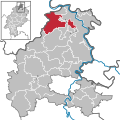
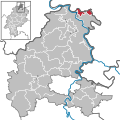
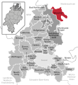
Category:Locator maps of municipalities in the Landkreis Kassel
Jump to navigation
Jump to search
Districts of Hesse:
Bergstraße · Darmstadt-Dieburg ≈ Darmstadt-Dieburg · Fulda · Gießen · Groß-Gerau · Hersfeld-Rotenburg · Hochtaunus · Kassel · Lahn-Dill · Limburg-Weilburg · Main-Kinzig · Main-Taunus · Marburg-Biedenkopf · Odenwald ≈ Odenwald · Offenbach · Rheingau-Taunus · Schwalm-Eder · Vogelsberg · Waldeck-Frankenberg · Werra-Meißner · Wetterau
Urban districts (cities):
Media in category "Locator maps of municipalities in the Landkreis Kassel"
The following 65 files are in this category, out of 65 total.
-
Ahnatal in KS mit Labels.svg 550 × 600; 311 KB
-
Ahnatal in KS.svg 2,136 × 2,136; 720 KB
-
Bad Emstal in KS mit Labels.svg 550 × 600; 311 KB
-
Bad Emstal in KS.svg 2,136 × 2,136; 720 KB
-
Bad Karlshafen in KS mit Labels.svg 550 × 600; 311 KB
-
Bad Karlshafen in KS.svg 2,136 × 2,136; 720 KB
-
Baunatal in KS mit Labels.svg 550 × 600; 311 KB
-
Baunatal in KS.svg 2,136 × 2,136; 720 KB
-
Breuna in KS mit Labels.svg 550 × 600; 311 KB
-
Breuna in KS.svg 2,136 × 2,136; 720 KB
-
Calden in KS mit Labels.svg 550 × 600; 311 KB
-
Calden in KS.svg 2,136 × 2,136; 720 KB
-
Espenau in KS mit Labels.svg 550 × 600; 311 KB
-
Espenau in KS.svg 2,136 × 2,136; 720 KB
-
Fuldabrück in KS mit Labels.svg 550 × 600; 311 KB
-
Fuldabrück in KS.svg 2,136 × 2,136; 720 KB
-
Fuldatal in KS mit Labels.svg 550 × 600; 311 KB
-
Fuldatal in KS.svg 2,136 × 2,136; 720 KB
-
Gemeinden im Landkreis Kassel mit Labels.svg 550 × 600; 311 KB
-
Grebenstein in KS mit Labels.svg 550 × 600; 311 KB
-
Grebenstein in KS.svg 2,136 × 2,136; 720 KB
-
Gutsbezirk Reinhardswald in KS mit Labels.svg 550 × 600; 311 KB
-
Gutsbezirk Reinhardswald in KS.svg 2,136 × 2,136; 720 KB
-
Habichtswald in KS mit Labels.svg 550 × 600; 311 KB
-
Habichtswald in KS.svg 2,136 × 2,136; 720 KB
-
Helsa in KS mit Labels.svg 550 × 600; 311 KB
-
Helsa in KS.svg 2,136 × 2,136; 720 KB
-
Hofgeismar in KS mit Labels.svg 550 × 600; 311 KB
-
Hofgeismar in KS.svg 2,136 × 2,136; 720 KB
-
Immenhausen in KS mit Labels.svg 550 × 600; 311 KB
-
Immenhausen in KS.svg 2,136 × 2,136; 720 KB
-
Kassel West.jpg 1,216 × 859; 103 KB
-
Kaufungen in KS mit Labels.svg 550 × 600; 311 KB
-
Kaufungen in KS.svg 2,136 × 2,136; 720 KB
-
Liebenau in KS mit Labels.svg 550 × 600; 311 KB
-
Liebenau in KS.svg 2,136 × 2,136; 720 KB
-
Lohfelden in KS mit Labels.svg 550 × 600; 311 KB
-
Lohfelden in KS.svg 2,136 × 2,136; 720 KB
-
Municipalities in KS.svg 2,136 × 2,136; 1.17 MB
-
Naumburg in KS mit Labels.svg 550 × 600; 311 KB
-
Naumburg in KS.svg 2,136 × 2,136; 720 KB
-
Nieste in KS mit Labels.svg 550 × 600; 311 KB
-
Nieste in KS.svg 2,136 × 2,136; 720 KB
-
Niestetal in KS mit Labels.svg 550 × 600; 311 KB
-
Niestetal in KS.svg 2,136 × 2,136; 720 KB
-
Oberweser in KS mit Labels.svg 550 × 600; 417 KB
-
Oberweser in KS.svg 2,136 × 2,136; 720 KB
-
Reinhardshagen in KS mit Labels.svg 550 × 600; 311 KB
-
Reinhardshagen in KS.svg 2,136 × 2,136; 720 KB
-
Reinhardswald.svg 550 × 600; 425 KB
-
Schauenburg in KS mit Labels.svg 550 × 600; 311 KB
-
Schauenburg in KS.svg 2,136 × 2,136; 720 KB
-
Söhrewald in KS mit Labels.svg 550 × 600; 311 KB
-
Söhrewald in KS.svg 2,136 × 2,136; 720 KB
-
Trendelburg in KS mit Labels.svg 550 × 600; 311 KB
-
Trendelburg in KS.svg 2,136 × 2,136; 720 KB
-
Vellmar in KS mit Labels.svg 550 × 600; 311 KB
-
Vellmar in KS.svg 2,136 × 2,136; 720 KB
-
Wahlsburg in KS mit Labels.svg 550 × 600; 414 KB
-
Wahlsburg in KS.svg 2,136 × 2,136; 720 KB
-
Wesertal in KS mit Labels.svg 550 × 600; 311 KB
-
Wolfhagen in KS mit Labels.svg 550 × 600; 311 KB
-
Wolfhagen in KS.svg 2,136 × 2,136; 720 KB
-
Zierenberg in KS mit Labels.svg 550 × 600; 311 KB
-
Zierenberg in KS.svg 2,136 × 2,136; 720 KB

