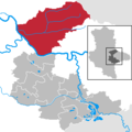
Category:Locator maps of municipalities in the Landkreis Anhalt-Bitterfeld
Jump to navigation
Jump to search
Districts of Saxony-Anhalt:
Urban districts (cities):
Subcategories
This category has only the following subcategory.
Media in category "Locator maps of municipalities in the Landkreis Anhalt-Bitterfeld"
The following 11 files are in this category, out of 11 total.
-
Aken (Elbe) in ABI.png 299 × 299; 4 KB
-
Bitterfeld-Wolfen in ABI.png 299 × 299; 4 KB
-
Köthen (Anhalt) in ABI.png 299 × 299; 4 KB
-
Muldestausee in ABI.png 299 × 299; 4 KB
-
Municipalities in ABI.png 299 × 299; 4 KB
-
Osternienburger Land in ABI.png 299 × 299; 4 KB
-
Raguhn-Jeßnitz in ABI.png 299 × 299; 4 KB
-
Sandersdorf-Brehna in ABI.png 299 × 299; 4 KB
-
Südliches Anhalt in ABI.png 299 × 299; 4 KB
-
Zerbst-Anhalt in ABI.png 299 × 299; 4 KB
-
Zörbig in ABI.png 299 × 299; 4 KB


