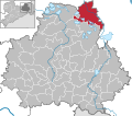
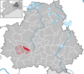
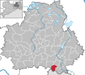
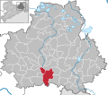
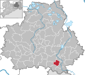
Category:Locator maps of municipalities in Landkreis Bautzen
Jump to navigation
Jump to search
Districts of Saxony:
Urban districts (cities):
Subcategories
This category has the following 2 subcategories, out of 2 total.
Media in category "Locator maps of municipalities in Landkreis Bautzen"
The following 66 files are in this category, out of 66 total.
-
Arnsdorf in BZ.svg 1,482 × 1,306; 336 KB
-
Bautzen in BZ.svg 1,482 × 1,306; 336 KB
-
Bernsdorf in BZ.svg 1,482 × 1,306; 336 KB
-
Bischofswerda in BZ.svg 1,482 × 1,306; 336 KB
-
Burkau in BZ.svg 1,482 × 1,306; 336 KB
-
Crostwitz in BZ.svg 1,482 × 1,306; 336 KB
-
Cunewalde in BZ.svg 1,482 × 1,306; 336 KB
-
Demitz-Thumitz in BZ.svg 1,482 × 1,306; 336 KB
-
Doberschau-Gaußig in BZ.svg 1,482 × 1,306; 336 KB
-
Elsterheide in BZ.svg 1,482 × 1,306; 336 KB
-
Elstra in BZ.svg 1,482 × 1,306; 336 KB
-
Frankenthal in BZ.svg 1,482 × 1,306; 336 KB
-
Großdubrau in BZ.svg 1,482 × 1,306; 336 KB
-
Großharthau in BZ.svg 1,482 × 1,306; 336 KB
-
Großnaundorf in BZ.svg 1,482 × 1,306; 336 KB
-
Großpostwitz in BZ.svg 1,482 × 1,306; 336 KB
-
Großröhrsdorf in BZ.svg 1,482 × 1,306; 336 KB
-
Göda in BZ.svg 1,482 × 1,306; 336 KB
-
Haselbachtal in BZ.svg 1,482 × 1,306; 336 KB
-
Hochkirch in BZ.svg 1,482 × 1,306; 336 KB
-
Hoyerswerda in BZ.svg 1,482 × 1,306; 336 KB
-
Kamenz in BZ.svg 1,482 × 1,306; 335 KB
-
Kubschütz in BZ.svg 1,482 × 1,306; 336 KB
-
Königsbrück in BZ.svg 1,482 × 1,306; 336 KB
-
Königswartha in BZ.svg 1,482 × 1,306; 336 KB
-
Lauta in BZ.svg 1,482 × 1,306; 336 KB
-
Laußnitz in BZ.svg 1,482 × 1,306; 336 KB
-
Lichtenberg in BZ.svg 1,482 × 1,306; 336 KB
-
Lohsa in BZ.svg 1,482 × 1,306; 336 KB
-
Malschwitz in BZ.svg 1,482 × 1,306; 336 KB
-
Municipalities in BZ hsb.svg 1,482 × 1,306; 850 KB
-
Municipalities in BZ.svg 1,482 × 1,306; 672 KB
-
Nebelschütz in BZ.svg 1,482 × 1,306; 336 KB
-
Neschwitz in BZ.svg 1,482 × 1,306; 336 KB
-
Neukirch in BZ.svg 1,482 × 1,306; 336 KB
-
Neukirch-Lausitz in BZ.svg 1,482 × 1,306; 336 KB
-
Obergurig in BZ.svg 1,482 × 1,306; 336 KB
-
Ohorn in BZ.svg 1,482 × 1,306; 336 KB
-
Ottendorf-Okrilla in BZ.svg 1,482 × 1,306; 336 KB
-
Oßling in BZ.svg 1,482 × 1,306; 336 KB
-
Panschwitz-Kuckau in BZ.svg 1,482 × 1,306; 336 KB
-
Pulsnitz in BZ.svg 1,482 × 1,306; 336 KB
-
Puschwitz in BZ.svg 1,482 × 1,306; 336 KB
-
Radeberg in BZ.svg 1,482 × 1,306; 336 KB
-
Radibor in BZ.svg 1,482 × 1,306; 336 KB
-
Ralbitz-Rosenthal in BZ.svg 1,482 × 1,306; 336 KB
-
Rammenau in BZ.svg 1,482 × 1,306; 336 KB
-
Räckelwitz in BZ.svg 1,482 × 1,306; 336 KB
-
Schirgiswalde-Kirschau in BZ.svg 1,482 × 1,306; 336 KB
-
Schmölln-Putzkau in BZ.svg 1,482 × 1,306; 336 KB
-
Schwepnitz in BZ.svg 1,482 × 1,306; 336 KB
-
Sohland an der Spree in BZ.svg 1,482 × 1,306; 336 KB
-
Spreetal in BZ.svg 1,482 × 1,306; 336 KB
-
Steina in BZ.svg 1,482 × 1,306; 336 KB
-
Steinigtwolmsdorf in BZ.svg 1,482 × 1,306; 336 KB
-
Verwaltungsgemeinschaft Bischofswerda in BZ.svg 1,482 × 1,306; 336 KB
-
Verwaltungsgemeinschaft Großharthau in BZ.svg 1,482 × 1,306; 336 KB
-
Verwaltungsgemeinschaft Großpostwitz-Obergurig in BZ.svg 1,482 × 1,306; 336 KB
-
Verwaltungsgemeinschaft Königsbrück in BZ.svg 1,482 × 1,306; 336 KB
-
Verwaltungsgemeinschaft Neschwitz in BZ.svg 1,482 × 1,306; 336 KB
-
Verwaltungsgemeinschaft Pulsnitz in BZ.svg 1,482 × 1,306; 336 KB
-
Verwaltungsverband Am Klosterwasser in BZ.svg 1,482 × 1,306; 336 KB
-
Wachau in BZ.svg 1,482 × 1,306; 336 KB
-
Weißenberg in BZ.svg 1,482 × 1,306; 336 KB
-
Wilthen in BZ.svg 1,482 × 1,306; 336 KB
-
Wittichenau in BZ.svg 1,482 × 1,306; 336 KB
