Category:Locator maps of municipalities in Enzkreis
Jump to navigation
Jump to search
Urban districts (cities):
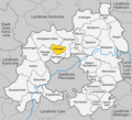
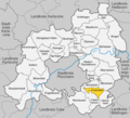
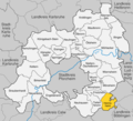
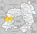
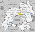
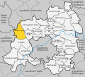
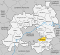
- English: This category contains maps of municipalities and collective municipalities in the Enzkreis, Baden-Württemberg.
- Deutsch: Diese Kategorie enthält Karten von Gemeinden und Gemeindeverbänden im Enzkreis in Baden-Württemberg.
Media in category "Locator maps of municipalities in Enzkreis"
The following 54 files are in this category, out of 54 total.
-
Birkenfeld im Enzkreis.png 1,000 × 910; 314 KB
-
Birkenfeld im Enzkreis.svg 1,000 × 910; 316 KB
-
Eisingen im Enzkreis.png 1,000 × 910; 314 KB
-
Eisingen im Enzkreis.svg 1,000 × 910; 316 KB
-
Engelsbrand im Enzkreis.png 1,000 × 910; 314 KB
-
Engelsbrand im Enzkreis.svg 1,000 × 910; 316 KB
-
Friolzheim im Enzkreis.png 1,000 × 910; 314 KB
-
Heimsheim im Enzkreis.png 1,000 × 910; 314 KB
-
Heimsheim im Enzkreis.svg 1,000 × 910; 316 KB
-
Illingen im Enzkreis.png 1,000 × 910; 314 KB
-
Illingen im Enzkreis.svg 1,000 × 910; 316 KB
-
Ispringen im Enzkreis.png 1,000 × 910; 313 KB
-
Ispringen im Enzkreis.svg 1,000 × 910; 316 KB
-
Keltern im Enzkreis.png 1,000 × 910; 314 KB
-
Keltern im Enzkreis.svg 1,000 × 910; 316 KB
-
Kieselbronn im Enzkreis.png 1,000 × 910; 313 KB
-
Kieselbronn im Enzkreis.svg 1,000 × 910; 316 KB
-
Knittlingen im Enzkreis.png 1,000 × 910; 314 KB
-
Knittlingen im Enzkreis.svg 1,000 × 910; 316 KB
-
Kämpfelbach im Enzkreis.png 1,000 × 910; 314 KB
-
Kämpfelbach im Enzkreis.svg 1,000 × 910; 316 KB
-
Königsbach-Stein im Enzkreis.png 1,000 × 910; 314 KB
-
Königsbach-Stein im Enzkreis.svg 1,000 × 910; 316 KB
-
Maulbronn im Enzkreis.png 1,000 × 910; 314 KB
-
Maulbronn im Enzkreis.svg 1,000 × 910; 316 KB
-
Mönsheim im Enzkreis.png 1,000 × 910; 314 KB
-
Mönsheim im Enzkreis.svg 1,000 × 910; 316 KB
-
Mühlacker im Enzkreis.png 1,000 × 910; 314 KB
-
Mühlacker im Enzkreis.svg 1,000 × 910; 316 KB
-
Neuenbürg im Enzkreis.png 1,000 × 910; 314 KB
-
Neuenbürg im Enzkreis.svg 1,000 × 910; 316 KB
-
Neuhausen im Enzkreis.png 1,000 × 910; 314 KB
-
Neulingen im Enzkreis.png 1,000 × 910; 314 KB
-
Neulingen im Enzkreis.svg 1,000 × 910; 316 KB
-
Niefern-Öschelbronn im Enzkreis.png 1,000 × 910; 314 KB
-
Niefern-Öschelbronn im Enzkreis.svg 1,000 × 910; 316 KB
-
Remchingen im Enzkreis.png 1,000 × 910; 314 KB
-
Remchingen im Enzkreis.svg 1,000 × 910; 316 KB
-
Sternenfels im Enzkreis.png 1,000 × 910; 314 KB
-
Sternenfels im Enzkreis.svg 1,000 × 910; 316 KB
-
Straubenhardt im Enzkreis.png 1,000 × 910; 314 KB
-
Straubenhardt im Enzkreis.svg 1,000 × 910; 316 KB
-
Tiefenbronn im Enzkreis.png 1,000 × 910; 314 KB
-
Tiefenbronn im Enzkreis.svg 1,000 × 910; 316 KB
-
Wiernsheim im Enzkreis.png 1,000 × 910; 314 KB
-
Wiernsheim im Enzkreis.svg 1,000 × 910; 316 KB
-
Wimsheim im Enzkreis.png 1,000 × 910; 314 KB
-
Wimsheim im Enzkreis.svg 1,000 × 910; 316 KB
-
Wurmberg im Enzkreis.png 1,000 × 910; 314 KB
-
Wurmberg im Enzkreis.svg 1,000 × 910; 316 KB
-
Ölbronn-Dürrn im Enzkreis.png 1,000 × 910; 314 KB
-
Ölbronn-Dürrn im Enzkreis.svg 1,000 × 910; 316 KB
-
Ötisheim im Enzkreis.png 1,000 × 910; 314 KB
-
Ötisheim im Enzkreis.svg 1,000 × 910; 316 KB


