Category:Locator maps of municipalities in Croatia
Jump to navigation
Jump to search
Subcategories
This category has the following 2 subcategories, out of 2 total.
*
I
Media in category "Locator maps of municipalities in Croatia"
The following 200 files are in this category, out of 242 total.
(previous page) (next page)-
 Antunovac municipality location.gif 544 × 514; 8 KB
-
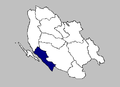
 Barilović Municipality (blue).PNG 332 × 422; 12 KB
-
 Barilović Municipality.PNG 332 × 422; 12 KB
-
 Beli manastir location.png 544 × 514; 9 KB
-
 Belica municipality location.png 283 × 168; 3 KB
-
 Belišće location.png 544 × 514; 9 KB
-
 Bellye.jpg 483 × 409; 27 KB
-
 Benkovac map-Croatia.PNG 418 × 266; 11 KB
-
 Benkovac Municipality.PNG 418 × 266; 11 KB
-
 Bibinje Municipality.PNG 418 × 266; 11 KB
-
 Bibinje-Croatia.PNG 418 × 266; 11 KB
-
 Bilje municipality location.gif 544 × 514; 8 KB
-
 Biograd na moru map-Croatia.PNG 418 × 266; 11 KB
-
 Biograd na Moru Municipality.PNG 418 × 266; 11 KB
-
 Bizovac municipality location.gif 544 × 514; 8 KB
-
 Bizovac.jpg 483 × 409; 27 KB
-
 Blato na Korčuli municipality map.PNG 910 × 477; 21 KB
-
 Bosiljevo Municipality.PNG 332 × 422; 12 KB
-
 Brinje municipality map.PNG 385 × 278; 7 KB
-
 Cetingrad Municipality.PNG 332 × 422; 12 KB
-
 Darda municipality location.gif 544 × 514; 8 KB
-
 Darázs.jpg 483 × 409; 27 KB
-
 Dekanovec municipality location.png 283 × 168; 3 KB
-
 Diakovár.jpg 483 × 409; 27 KB
-
 Districts of Split (map with numbers).svg 1,200 × 459; 128 KB
-
 Domašinec municipality location.png 283 × 168; 3 KB
-
 Donja Dubrava municipality location.png 283 × 168; 3 KB
-
 Donja Motičina municipality location.png 544 × 514; 9 KB
-
 Donji Kraljevec municipality location.png 283 × 168; 3 KB
-
 Donji Kukuruzari Municipality.PNG 487 × 329; 13 KB
-
 Donji Lapac municipality map.PNG 385 × 278; 7 KB
-
 Donji miholjac location.png 544 × 514; 9 KB
-
 Donji Vidovec municipality location.png 283 × 168; 3 KB
-
 Draganić municipality.PNG 332 × 422; 12 KB
-
 Draž municipality location.png 544 × 514; 9 KB
-
 Drenje municipality location.png 544 × 514; 9 KB
-
 Dubrovačko Primorje-municipality map.PNG 910 × 477; 21 KB
-
 Duga Resa city.PNG 332 × 422; 12 KB
-
 Duga Resa Municipality.PNG 332 × 422; 12 KB
-
 Dvor Municipality.PNG 487 × 329; 13 KB
-
 Dárda.jpg 483 × 409; 27 KB
-
 Erdut municipality location.gif 544 × 514; 8 KB
-
 Ernestinovo municipality location.gif 544 × 514; 8 KB
-
 Feričanci municipality location.gif 544 × 514; 8 KB
-
 Galovac Municipality.PNG 418 × 266; 11 KB
-
 Galovac-Croatia.PNG 418 × 266; 11 KB
-
 Gemeinde Antunovac.jpg 483 × 409; 42 KB
-
 Gemeinde Beli Manastir.jpg 483 × 409; 42 KB
-
 Gemeinde Belišće.jpg 483 × 409; 42 KB
-
 Gemeinde Bilje.jpg 483 × 409; 42 KB
-
 Gemeinde Bizovac.jpg 483 × 409; 42 KB
-
 Gemeinde Darda.jpg 483 × 409; 42 KB
-
 Gemeinde Donja Motičina.jpg 483 × 409; 42 KB
-
 Gemeinde Donji Miholjac.jpg 483 × 409; 42 KB
-
 Gemeinde Draž.jpg 483 × 409; 42 KB
-
 Gemeinde Drenje.jpg 483 × 409; 42 KB
-
 Gemeinde Erdut.jpg 483 × 409; 42 KB
-
 Gemeinde Ernestinovo.jpg 483 × 409; 42 KB
-
 Gemeinde Feričanci.jpg 483 × 409; 42 KB
-
 Gemeinde Gorjani.jpg 483 × 409; 42 KB
-
 Gemeinde Jagodnjak.jpg 483 × 409; 42 KB
-
 Gemeinde Kneževi Vinogradi.jpg 483 × 409; 42 KB
-
 Gemeinde Koška.jpg 483 × 409; 42 KB
-
 Gemeinde Levanjska Varoš.jpg 483 × 409; 42 KB
-
 Gemeinde Magadenovac.jpg 483 × 409; 42 KB
-
 Gemeinde Marijanci.jpg 483 × 409; 42 KB
-
 Gemeinde Našice.jpg 483 × 409; 42 KB
-
 Gemeinde Osijek.jpg 483 × 409; 42 KB
-
 Gemeinde Petlovac.jpg 483 × 409; 42 KB
-
 Gemeinde Podravska Moslavina.jpg 483 × 409; 42 KB
-
 Gemeinde Popovac.jpg 483 × 409; 42 KB
-
 Gemeinde Punitovci.jpg 483 × 409; 42 KB
-
 Gemeinde Satnica Đakovačka.jpg 483 × 409; 42 KB
-
 Gemeinde Semeljci.jpg 483 × 409; 42 KB
-
 Gemeinde Strizivojna.jpg 483 × 409; 42 KB
-
 Gemeinde Trnava.jpg 483 × 409; 42 KB
-
 Gemeinde Valpovo.jpg 483 × 409; 42 KB
-
 Gemeinde Viljevo.jpg 483 × 409; 42 KB
-
 Gemeinde Viškovci.jpg 483 × 409; 42 KB
-
 Gemeinde Vladislavci.jpg 483 × 409; 42 KB
-
 Gemeinde Vuka.jpg 483 × 409; 42 KB
-
 Gemeinde Čeminac.jpg 483 × 409; 42 KB
-
 Gemeinde Čepin.jpg 483 × 409; 42 KB
-
 Gemeinde Đakovo.jpg 483 × 409; 42 KB
-
 Gemeinde Đurdenovac.jpg 483 × 409; 42 KB
-
 Gemeinde Šodolovci.jpg 483 × 409; 42 KB
-
 Gemeinde Šodotovci.jpg 483 × 409; 42 KB
-
 Generalski Stol Municipality.PNG 332 × 422; 12 KB
-
 Glina Municipality.PNG 487 × 329; 13 KB
-
 Goričan municipality location.GIF 283 × 168; 3 KB
-
 Gorjani municipality location.gif 544 × 514; 8 KB
-
 Gornji Mihaljevec municipality location.GIF 283 × 168; 3 KB
-
 Grad Vrlika u SDŽ.png 795 × 547; 18 KB
-
 Gračac Municipality.PNG 418 × 266; 11 KB
-
 Gračac-map-Croatia.PNG 418 × 266; 9 KB
-
 Gvozd Municipality.png 487 × 329; 10 KB
-
 Gvozd Municipality.PNG 487 × 329; 13 KB
-
 Herczegszöllös.jpg 483 × 409; 27 KB
-
 Hrvatska Dubica Municipality.PNG 487 × 329; 13 KB
-
 Hrvatska Kostajnica city map.PNG 487 × 329; 13 KB
-
 IlokMunicipality.PNG 635 × 597; 74 KB
-
 Imotski Municipality.PNG 795 × 547; 25 KB
-
 Jagodnjak municipality location.GIF 411 × 369; 7 KB
-
 Janjina municipality map.PNG 910 × 477; 21 KB
-
 Jasenice map-Croatia.PNG 418 × 266; 11 KB
-
 Jasenice Municipality.PNG 418 × 266; 11 KB
-
 Jasenovac Municipality.PNG 487 × 329; 13 KB
-
 Josipdol Municipality.PNG 332 × 422; 12 KB
-
 KaliCroatia Municipality.PNG 418 × 266; 11 KB
-
 Kamanje Municipality.PNG 332 × 422; 12 KB
-
 Karlobag municipality map.PNG 385 × 278; 7 KB
-
 Karlobag.PNG 385 × 278; 7 KB
-
 Karlovac city.PNG 332 × 422; 12 KB
-
 Kneževi Vinogradi municipality location.GIF 544 × 514; 8 KB
-
 Konavle municipality.PNG 910 × 477; 21 KB
-
 Kotoriba municipality location.GIF 283 × 168; 3 KB
-
 Koška municipality location.GIF 544 × 514; 8 KB
-
 Krnjak Municipality.PNG 332 × 422; 12 KB
-
 Kukljica Municipality.PNG 418 × 266; 11 KB
-
 Kutina Municipality.PNG 487 × 329; 13 KB
-
 Lasinja Municipality.PNG 332 × 422; 12 KB
-
 Lekenik Municipality.PNG 487 × 329; 13 KB
-
 Levanjska Varoš municipality location.GIF 544 × 514; 8 KB
-
 Lipovljani Municipality.PNG 487 × 329; 13 KB
-
 Lovinac municipality map.PNG 385 × 278; 7 KB
-
 Lumbarda municipality map.PNG 910 × 477; 21 KB
-
 Magadenovac municipality location.GIF 544 × 514; 8 KB
-
 Majur Municipality.PNG 487 × 329; 13 KB
-
 Mala Subotica municipality location.GIF 283 × 168; 3 KB
-
 Marijanci municipality location.GIF 544 × 514; 8 KB
-
 Martinska ves Municipality.PNG 487 × 329; 13 KB
-
 Mursko Središće city location.GIF 283 × 168; 3 KB
-
 Našice location.gif 544 × 514; 8 KB
-
 Nedelišće municipality location.GIF 283 × 168; 3 KB
-
 Nekcse.jpg 483 × 409; 27 KB
-
 Netretić Municipality.PNG 332 × 422; 12 KB
-
 Nin Croatia Municipality.PNG 418 × 266; 11 KB
-
 Nin map-Croatia.PNG 418 × 266; 11 KB
-
 Novigrad map-Croatia.PNG 418 × 266; 11 KB
-
 NovigradZadar Municipality.PNG 418 × 266; 11 KB
-
 Novska city.PNG 487 × 329; 13 KB
-
 Novska Municipality.PNG 487 × 329; 13 KB
-
 Obrovac-town-Croatia.png 418 × 266; 11 KB
-
 ObrovacCroatia Municipality.PNG 418 × 266; 11 KB
-
 Ogulin city.PNG 332 × 422; 12 KB
-
 Ogulin Municipality.PNG 332 × 422; 12 KB
-
 Okrug municpality u SDŽ.png 795 × 547; 18 KB
-
 Općina Hrvace u SDŽ.png 795 × 547; 18 KB
-
 Općina Lećevica u SDŽ.PNG 795 × 547; 25 KB
-
 Orebić municipality map.PNG 910 × 477; 21 KB
-
 Orehovica municipality location.GIF 283 × 168; 3 KB
-
 Osijek location.gif 544 × 514; 8 KB
-
 Otočac.PNG 385 × 278; 7 KB
-
 Ozalj Municipality.PNG 332 × 422; 12 KB
-
 Pakoštane map-Croatia.PNG 418 × 266; 11 KB
-
 Pašman map-Croatia.PNG 418 × 266; 11 KB
-
 Perušić municipalitymap.PNG 385 × 278; 7 KB
-
 Petlovac municipality location.GIF 425 × 369; 7 KB
-
 Petrijevci municipality location.GIF 544 × 514; 8 KB
-
 Petrinja city map.PNG 487 × 329; 13 KB
-
 Petrinja Municipality.PNG 487 × 329; 13 KB
-
 Plitvička jezera municipality map.PNG 385 × 278; 7 KB
-
 Plitvička Jezera.PNG 385 × 278; 7 KB
-
 Podgorač municipality location.GIF 544 × 514; 8 KB
-
 Podravska Moslavina municipality location.GIF 544 × 514; 8 KB
-
 Podturen municipality location.GIF 283 × 168; 3 KB
-
 Polača map-Croatia.PNG 418 × 266; 11 KB
-
 Poličnik map-Croatia.PNG 418 × 266; 11 KB
-
 Popovac municipality location.GIF 425 × 369; 7 KB
-
 Popovača Municipality.PNG 487 × 329; 13 KB
-
 Posedarje map-Croatia.PNG 418 × 266; 11 KB
-
 Posedarje Municipality.PNG 418 × 266; 11 KB
-
 Povljana map-Croatia.PNG 418 × 266; 11 KB
-
 Povljane Municipality.PNG 418 × 266; 11 KB
-
 Preko map-Croatia.PNG 418 × 266; 11 KB
-
 Prelog city location.GIF 283 × 168; 3 KB
-
 Pribislavec municipality location.GIF 283 × 168; 3 KB
-
 Privlaka map-Croatia.PNG 418 × 266; 11 KB
-
 Punitovci municipality location.GIF 544 × 514; 8 KB
-
 Pélmonostor.jpg 483 × 409; 27 KB
-
 Rakovica Karlovac County Municipality.PNG 332 × 422; 12 KB
-
 Rakovica Municipality.PNG 332 × 422; 12 KB
-
 Ražanac map-Croatia.PNG 418 × 266; 11 KB
-
 Ribnik Croatia Municipality.PNG 332 × 422; 12 KB
-
 Ribnik Municipality.PNG 332 × 422; 12 KB
-
 Saborsko Municipality.PNG 332 × 422; 12 KB
-
 Sali map-Croatia.PNG 418 × 266; 11 KB
-
 Satnica Đakovačka municipality location.GIF 544 × 514; 8 KB
-
 Selnica municipality location.GIF 283 × 168; 3 KB
-
 Semeljci municipality location.GIF 544 × 514; 8 KB
-
 Senj.PNG 385 × 278; 7 KB
-
 Sisak city.PNG 487 × 329; 13 KB
-
 Sisak Municipality.PNG 487 × 329; 13 KB
-
 Slunj city.PNG 332 × 422; 12 KB
-
 Slunj Municipality.PNG 332 × 422; 12 KB
-
 Stankovci map-Croatia.PNG 418 × 266; 11 KB
-
 Starigrad map-Croatia.PNG 418 × 266; 11 KB
-
 Ston municipality map.PNG 910 × 477; 21 KB
-
 Strahoninec municipality location.GIF 283 × 168; 3 KB
-
 Strizivojna municipality location-krivio.GIF 544 × 514; 7 KB

.PNG)


.svg)