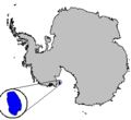
Category:Locator maps of islands of Antarctica
Jump to navigation
Jump to search
Subcategories
This category has the following 7 subcategories, out of 7 total.
Media in category "Locator maps of islands of Antarctica"
The following 24 files are in this category, out of 24 total.
-
"http---collocazione.geographic.islands".jpg 3,067 × 2,836; 5.03 MB
-
Alexander eiland.PNG 686 × 599; 98 KB
-
Alexander Island.PNG 306 × 307; 16 KB
-
Antarctica - Location of Possession Islands.png 330 × 355; 16 KB
-
Antarctica map indicating Antarctic Peninsula-ar.jpg 5,966 × 5,420; 584 KB
-
Antarctica map indicating Antarctic Peninsula.JPG 1,074 × 976; 222 KB
-
Antarctica Peter I Island.png 300 × 275; 3 KB
-
Antarctica Ross Island relief location map.png 2,986 × 2,986; 7.65 MB
-
Antarctica, Norway territorial claim (Peter I Island).svg 806 × 806; 34 KB
-
AntDotMap Livingston.png 200 × 200; 20 KB
-
AntDotMap Manning.png 200 × 200; 19 KB
-
LocationBalleny.png 200 × 200; 19 KB
-
Balleny Islands.PNG 500 × 379; 95 KB
-
Carney Island Antarctica.png 300 × 275; 3 KB
-
Image Siple Island Antarctica.png 300 × 275; 3 KB
-
Isla Berkner.JPG 567 × 567; 24 KB
-
Isola Berkner.JPG 567 × 567; 24 KB
-
LocatieHeardMcDonald.png 252 × 115; 4 KB
-
Roosevelt Island Antarctica.png 300 × 275; 3 KB
-
RossIsland-pos.png 2,380 × 1,978; 157 KB
-
Scott Island.PNG 306 × 307; 16 KB
-
Thurston Island Antarctica.png 300 × 275; 3 KB
-
Wfm antarctic peninsula islands.png 738 × 703; 184 KB
-
Wiese Islands-2.png 818 × 682; 59 KB


