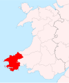
Category:Locator maps of historic counties of Wales
Jump to navigation
Jump to search
Media in category "Locator maps of historic counties of Wales"
The following 114 files are in this category, out of 114 total.
-
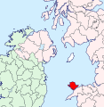
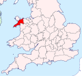
Anglesey - British Isles.svg 1,250 × 1,835; 1,024 KB
-
Anglesey Brit Isles Sect 3.svg 939 × 677; 1,012 KB
-
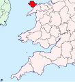
Anglesey Brit Isles Sect 4.svg 627 × 643; 1,012 KB
-
Anglesey Brit Isles Sect 5.svg 809 × 743; 939 KB
-
Anglesey Brit Isles Sect 6.svg 545 × 593; 938 KB
-
AngleseyBrit6.PNG 398 × 459; 11 KB
-
AngleseyBrit6.png 398 × 459; 8 KB
-
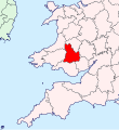
Brecknockshire - British Isles.svg 1,250 × 1,835; 1,024 KB
-
Brecknockshire Brit Isles Sect 5.svg 809 × 743; 939 KB
-
Brecknockshire Brit Isles Sect 6.svg 545 × 593; 939 KB
-
BrecknockshireBrit5.PNG 625 × 569; 26 KB
-
BrecknockshireBrit5.png 625 × 569; 13 KB
-
Caernarfonshire - British Isles.svg 1,250 × 1,835; 1,024 KB
-
Caernarfonshire Brit Isles Sect 3.svg 939 × 677; 1,012 KB
-
Caernarfonshire Brit Isles Sect 4.svg 627 × 643; 1,012 KB
-
Caernarfonshire Brit Isles Sect 5.svg 809 × 743; 939 KB
-
Caernarfonshire Brit Isles Sect 6.svg 545 × 593; 938 KB
-
CaernarfonshireBrit6.PNG 398 × 459; 11 KB
-
CaernarfonshireBrit6.png 398 × 459; 8 KB
-
Cardiganshire - British Isles.svg 1,250 × 1,835; 1,024 KB
-
Cardiganshire Brit Isles Sect 5.svg 809 × 743; 939 KB
-
Cardiganshire Brit Isles Sect 6.svg 545 × 593; 939 KB
-
CardiganshireBrit6.PNG 398 × 459; 11 KB
-
CardiganshireBrit6.png 398 × 459; 8 KB
-
Carmarthenshire - British Isles.svg 1,250 × 1,835; 1,024 KB
-
Carmarthenshire Brit Isles Sect 5.svg 809 × 743; 939 KB
-
Carmarthenshire Brit Isles Sect 6.svg 545 × 593; 938 KB
-
CarmarthenshireBrit6.PNG 398 × 459; 11 KB
-
CarmarthenshireBrit6.png 398 × 459; 8 KB
-
Denbighshire - British Isles.svg 1,250 × 1,835; 1,024 KB
-
Denbighshire Brit Isles Sect 3.svg 939 × 677; 1,012 KB
-
Denbighshire Brit Isles Sect 4.svg 627 × 643; 1,012 KB
-
Denbighshire Brit Isles Sect 5.svg 809 × 743; 939 KB
-
Denbighshire Brit Isles Sect 6.svg 545 × 593; 938 KB
-
DenbighshireBrit6.PNG 398 × 459; 11 KB
-
DenbighshireBrit6.png 398 × 459; 8 KB
-
Flintshire - British Isles.svg 1,250 × 1,835; 1,024 KB
-
Flintshire Brit Isles Sect 3.svg 939 × 677; 1,012 KB
-
Flintshire Brit Isles Sect 4.svg 627 × 643; 1,012 KB
-
Flintshire Brit Isles Sect 5.svg 809 × 743; 939 KB
-
Flintshire Brit Isles Sect 6.svg 545 × 593; 938 KB
-
Flintshire Map.png 4,967 × 4,967; 4.16 MB
-
FlintshireBrit3.PNG 698 × 491; 28 KB
-
FlintshireBrit6.GIF 398 × 459; 8 KB
-
FlintshireBrit6.PNG 398 × 459; 11 KB
-
Glamorgan - British Isles.svg 1,250 × 1,835; 1,024 KB
-
Glamorgan Brit Isles Sect 5.svg 809 × 743; 939 KB
-
Glamorgan Brit Isles Sect 6.svg 545 × 593; 938 KB
-
GlamorganBrit5.GIF 625 × 569; 12 KB
-
GlamorganBrit5.PNG 625 × 569; 26 KB
-
Map showing the traditional, geographical county of Anglesey, Ynys Mon.png 4,967 × 4,967; 4.75 MB
-
Map showing the traditional, geographical county of Cardiganshire Ceredigion, Wales.png 4,967 × 4,967; 4.13 MB
-
Map showing the traditional, geographical county of Denbighshire Sir Ddinbych, Wales.png 4,967 × 4,967; 4.13 MB
-
Map showing the traditional, geographical county of Glamorgan Morgannwg, Wales.png 4,967 × 4,967; 4.14 MB
-
MerionethBrit6.GIF 398 × 459; 8 KB
-
MerionethBrit6.PNG 398 × 459; 11 KB
-
Merionethshire - British Isles.svg 1,250 × 1,835; 1,024 KB
-
Merionethshire Brit Isles Sect 3.svg 939 × 677; 1,012 KB
-
Merionethshire Brit Isles Sect 5.svg 809 × 743; 939 KB
-
Merionethshire Brit Isles Sect 6.svg 545 × 593; 938 KB
-
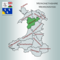
Merionethshire Meirionnydd Map.png 4,967 × 4,967; 4.17 MB
-
Monmouthshire - British Isles.svg 1,250 × 1,835; 1,024 KB
-
Monmouthshire Brit Isles Sect 5.svg 809 × 743; 939 KB
-
Monmouthshire Brit Isles Sect 6.svg 545 × 593; 938 KB
-
Monmouthshire Map.png 4,967 × 4,967; 4.15 MB
-
MonmouthshireBrit5.GIF 625 × 569; 12 KB
-
MonmouthshireBrit5.PNG 625 × 569; 26 KB
-
Montgomeryshire - British Isles.svg 1,250 × 1,835; 1,024 KB
-
Montgomeryshire Brit Isles Sect 5.svg 809 × 743; 939 KB
-
Montgomeryshire Brit Isles Sect 6.svg 545 × 593; 938 KB
-
Montgomeryshire Map.png 4,967 × 4,967; 4.12 MB
-
MontgomeryshireBrit6.GIF 398 × 459; 8 KB
-
MontgomeryshireBrit6.PNG 398 × 459; 11 KB
-
Pembrokeshire - British Isles.svg 1,250 × 1,835; 1,024 KB
-
Pembrokeshire Brit Isles Sect 5.svg 809 × 743; 939 KB
-
Pembrokeshire Brit Isles Sect 6.svg 545 × 593; 938 KB
-
Pembrokeshire Map.png 4,967 × 4,967; 4.11 MB
-
PembrokeshireBrit6.GIF 398 × 459; 8 KB
-
PembrokeshireBrit6.PNG 398 × 459; 11 KB
-
Radnorshire - British Isles.svg 1,250 × 1,835; 1,024 KB
-
Radnorshire Brit Isles Sect 5.svg 809 × 743; 939 KB
-
Radnorshire Brit Isles Sect 6.svg 545 × 593; 938 KB
-
Radnorshire Map.png 4,967 × 4,967; 4.13 MB
-
RadnorshireBrit6.GIF 398 × 459; 8 KB
-
RadnorshireBrit6.PNG 398 × 459; 11 KB
-
Wales Historic Counties map Anglesey.svg 512 × 612; 179 KB
-
Wales Historic Counties map Brecknockshire.svg 512 × 612; 177 KB
-
Wales Historic Counties map Caernarfonshire.svg 512 × 612; 180 KB
-
Wales Historic Counties map Cardiganshire.svg 512 × 612; 178 KB
-
Wales Historic Counties map Carmarthenshire.svg 512 × 612; 179 KB
-
Wales Historic Counties map Denbighshire.svg 512 × 612; 179 KB
-
Wales Historic Counties map Flintshire.svg 512 × 612; 177 KB
-
Wales Historic Counties map Glamorgan.svg 512 × 612; 178 KB
-
Wales Historic Counties map Merionethshire.svg 512 × 612; 178 KB
-
Wales Historic Counties map Monmouthshire.svg 512 × 612; 177 KB
-
Wales Historic Counties map Montgomeryshire.svg 512 × 612; 178 KB
-
Wales Historic Counties map Pembrokeshire.svg 512 × 612; 182 KB
-
Wales Historic Counties map Radnorshire.svg 512 × 612; 177 KB
-
WalesAngleseyTrad.png 200 × 250; 24 KB
-
WalesBrecknockshireTrad.png 200 × 250; 24 KB
-
WalesCaernarfonshireTrad.png 200 × 250; 24 KB
-
WalesCardiganshireTrad.png 200 × 250; 24 KB
-
WalesDenbighshireTrad.png 200 × 250; 23 KB
-
WalesFlintshireTrad.png 200 × 250; 24 KB
-
WalesGlamorganTrad.png 200 × 250; 14 KB
-
WalesMerionethTrad.png 200 × 250; 24 KB
-
WalesMonmouthshireTrad.png 200 × 250; 24 KB
-
WalesMontgomeryshireTrad.png 200 × 250; 24 KB
-
WalesPembrokeshireTrad.png 200 × 250; 24 KB
-
WalesRadnorshireTrad.png 200 × 250; 24 KB
-
WalesTradNumbered.png 400 × 499; 61 KB


