Category:Locator maps of former countries by User:Milenioscuro
Jump to navigation
Jump to search
Media in category "Locator maps of former countries by User:Milenioscuro"
The following 27 files are in this category, out of 27 total.
-
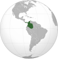
Granadine Confederation (orthographic projection).svg 550 × 550; 439 KB
-
Great Colombia (orthographic projection).svg 550 × 550; 467 KB
-
New Granada (orthographic projection).svg 550 × 550; 444 KB
-
United States of Colombia (orthographic projection).svg 550 × 550; 440 KB
-
Viceroyalty of New Granada (orthographic projection).svg 550 × 550; 429 KB
-
Benin Republic in its region (1967).svg 361 × 231; 251 KB
-
Biafra in its region.svg 361 × 231; 254 KB
-
British Somaliland in its region.svg 556 × 315; 283 KB
-
Central African Empire in its region.svg 490 × 276; 292 KB
-
Ethiopia in its region (before 1993).svg 556 × 315; 259 KB
-
First Mexican Empire on the globe.svg 792 × 792; 1.89 MB
-
First Mexican Federal Republic on the globe.svg 792 × 792; 1.89 MB
-
Italian Somaliland in its region.svg 556 × 315; 283 KB
-
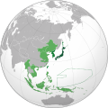
Japanese Empire (orthographic projection).svg 600 × 600; 665 KB
-
Mali Federation in its region (1959).svg 443 × 282; 257 KB
-
Mali Federation in its region.svg 443 × 282; 261 KB
-
Mexican Centralist Republic on the globe.svg 792 × 792; 1.91 MB
-
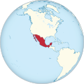
Mexico on the globe.svg 792 × 792; 2.09 MB
-
North Vietnam in its region.svg 617 × 342; 447 KB
-
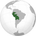
Peru–Bolivia Confederation (orthographic projection).svg 541 × 541; 300 KB
-
Russian Empire (orthographic projection).svg 541 × 541; 393 KB
-
Second Mexican Empire on the globe.svg 792 × 792; 1.86 MB
-
Second Mexican Federal Republic on the globe.svg 792 × 792; 1.87 MB
-
Senegambia in its region.svg 443 × 282; 231 KB
-
South Africa in its region (1990).svg 478 × 303; 207 KB
-
South Vietnam in its region.svg 617 × 342; 447 KB
-
Union of South Africa in its region.svg 478 × 303; 210 KB


