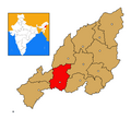
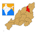
Category:Locator maps of districts of Nagaland
Jump to navigation
Jump to search
Subcategories
This category has only the following subcategory.
Media in category "Locator maps of districts of Nagaland"
The following 12 files are in this category, out of 12 total.
-
Nagaland Dimapur district map.png 445 × 405; 10 KB
-
Nagaland districts map.png 445 × 405; 15 KB
-
Nagaland Kiphire district map.png 445 × 405; 10 KB
-
Nagaland Kohima district map.png 445 × 405; 10 KB
-
Nagaland Longleng district map.png 445 × 405; 10 KB
-
Nagaland Mokokchung district map.png 445 × 405; 10 KB
-
Nagaland Mon district map.png 445 × 405; 10 KB
-
Nagaland Peren district map.png 445 × 405; 10 KB
-
Nagaland Phek district map.png 445 × 405; 10 KB
-
Nagaland Tuensang district map.png 445 × 405; 10 KB
-
Nagaland Wokha district map.png 445 × 405; 10 KB
-
Nagaland Zunheboto district map.png 445 × 405; 10 KB


