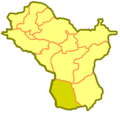
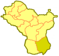
Category:Locator maps of districts of East Kazakhstan Region
Jump to navigation
Jump to search
Media in category "Locator maps of districts of East Kazakhstan Region"
The following 21 files are in this category, out of 21 total.
-
East Kazakhstan Province Glubokoe.png 535 × 505; 21 KB
-
East Kazakhstan Province Katonkaragay.png 535 × 505; 21 KB
-
East Kazakhstan Province Kurshim.png 535 × 505; 21 KB
-
East Kazakhstan Province Markakol.png 535 × 505; 21 KB
-
East Kazakhstan Province Ridder.png 535 × 505; 21 KB
-
East Kazakhstan Province Samar.png 535 × 505; 21 KB
-
East Kazakhstan Province Shemonaikha.png 535 × 505; 22 KB
-
East Kazakhstan Province Tarbagatay.png 535 × 505; 21 KB
-
East Kazakhstan Province Ulan.png 535 × 505; 21 KB
-
East Kazakhstan Province Ulken-Naryn.png 535 × 505; 22 KB
-
East Kazakhstan Province Ust-Kamen.png 535 × 505; 21 KB
-
East Kazakhstan Province Zaysan.png 535 × 505; 21 KB
-
East Kazakhstan Province Zyryan.png 535 × 505; 21 KB
-
Glubokoe District Kazakhstan.png 1,598 × 1,022; 350 KB
-
Katonkaragay District Kazakhstan.png 1,598 × 1,022; 332 KB
-
Kurshim District Kazakhstan.png 1,598 × 1,022; 351 KB
-
Samar District Kazakhstan.png 1,598 × 1,022; 59 KB
-
Tarbagatay District Kazakhstan.png 1,598 × 1,022; 59 KB
-
Ulan District Kazakhstan.png 1,598 × 1,022; 350 KB
-
Zaysan District Kazakhstan.png 1,598 × 1,022; 350 KB
-
Zyryan District Kazakhstan.png 1,598 × 1,022; 350 KB


