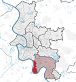
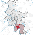
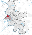
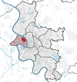
Category:Locator maps of districts of Düsseldorf
Jump to navigation
Jump to search
Media in category "Locator maps of districts of Düsseldorf"
The following 132 files are in this category, out of 132 total.
-
Altstadt.svg 448 × 598; 1.01 MB
-
Duesseldorf Districts.png 600 × 605; 147 KB
-
Duesseldorf Unterbach.png 1,633 × 2,363; 609 KB
-
Düsseldorf Stadtbezirk 01.svg 924 × 992; 2.52 MB
-
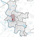
Düsseldorf Stadtbezirk 02.svg 924 × 992; 2.52 MB
-
Düsseldorf Stadtbezirk 03.svg 924 × 992; 2.52 MB
-
Düsseldorf Stadtbezirk 04.svg 924 × 992; 2.52 MB
-
Düsseldorf Stadtbezirk 05.svg 924 × 992; 2.52 MB
-
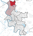
Düsseldorf Stadtbezirk 06.svg 924 × 992; 2.52 MB
-
Düsseldorf Stadtbezirk 07.svg 924 × 992; 2.52 MB
-
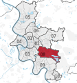
Düsseldorf Stadtbezirk 08.svg 924 × 992; 2.52 MB
-
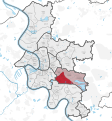
Düsseldorf Stadtbezirk 09.svg 924 × 992; 2.52 MB
-
Düsseldorf Stadtbezirk 10.svg 924 × 992; 2.52 MB
-
Düsseldorf Stadtteil Altstadt.svg 924 × 992; 2.47 MB
-
Düsseldorf Stadtteil Angermund.svg 924 × 992; 2.47 MB
-
Düsseldorf Stadtteil Benrath.svg 924 × 992; 2.47 MB
-
Düsseldorf Stadtteil Bilk.svg 924 × 992; 2.47 MB
-
Düsseldorf Stadtteil Carlstadt.svg 924 × 992; 2.47 MB
-
Düsseldorf Stadtteil Derendorf.svg 924 × 992; 2.47 MB
-
Düsseldorf Stadtteil Düsseltal.svg 924 × 992; 2.47 MB
-
Düsseldorf Stadtteil Eller.svg 924 × 992; 2.47 MB
-
Düsseldorf Stadtteil Flehe.svg 924 × 992; 2.47 MB
-
Düsseldorf Stadtteil Flingern-Nord.svg 924 × 992; 2.47 MB
-
Düsseldorf Stadtteil Flingern-Süd.svg 924 × 992; 2.47 MB
-
Düsseldorf Stadtteil Friedrichstadt.svg 924 × 992; 2.47 MB
-
Düsseldorf Stadtteil Garath.svg 924 × 992; 2.47 MB
-
Düsseldorf Stadtteil Gerresheim.svg 924 × 992; 2.47 MB
-
Düsseldorf Stadtteil Golzheim.svg 924 × 992; 2.47 MB
-
Düsseldorf Stadtteil Grafenberg.svg 924 × 992; 2.47 MB
-
Düsseldorf Stadtteil Hafen.svg 924 × 992; 2.47 MB
-
Düsseldorf Stadtteil Hassels.svg 924 × 992; 2.47 MB
-
Düsseldorf Stadtteil Heerdt.svg 924 × 992; 2.47 MB
-
Düsseldorf Stadtteil Hellerhof.svg 924 × 992; 2.47 MB
-
Düsseldorf Stadtteil Himmelgeist.svg 924 × 992; 2.47 MB
-
Düsseldorf Stadtteil Holthausen.svg 924 × 992; 2.47 MB
-
Düsseldorf Stadtteil Hubbelrath.svg 924 × 992; 2.47 MB
-
Düsseldorf Stadtteil Itter.svg 924 × 992; 2.47 MB
-
Düsseldorf Stadtteil Kaiserswerth.svg 924 × 992; 2.47 MB
-
Düsseldorf Stadtteil Kalkum.svg 924 × 992; 2.47 MB
-
Düsseldorf Stadtteil Lichtenbroich.svg 924 × 992; 2.47 MB
-
Düsseldorf Stadtteil Lierenfeld.svg 924 × 992; 2.47 MB
-
Düsseldorf Stadtteil Lohausen.svg 924 × 992; 2.47 MB
-
Düsseldorf Stadtteil Ludenberg.svg 924 × 992; 2.47 MB
-
Düsseldorf Stadtteil Lörick.svg 924 × 992; 2.47 MB
-
Düsseldorf Stadtteil Mörsenbroich.svg 924 × 992; 2.47 MB
-
Düsseldorf Stadtteil Niederkassel.svg 924 × 992; 2.47 MB
-
Düsseldorf Stadtteil Oberbilk.svg 924 × 992; 2.47 MB
-
Düsseldorf Stadtteil Oberkassel.svg 924 × 992; 2.47 MB
-
Düsseldorf Stadtteil Pempelfort.svg 924 × 992; 2.47 MB
-
Düsseldorf Stadtteil Rath.svg 924 × 992; 2.47 MB
-
Düsseldorf Stadtteil Stadtmitte.svg 924 × 992; 2.47 MB
-
Düsseldorf Stadtteil Stockum.svg 924 × 992; 2.47 MB
-
Düsseldorf Stadtteil Unterbach.svg 924 × 992; 2.47 MB
-
Düsseldorf Stadtteil Unterbilk.svg 924 × 992; 2.47 MB
-
Düsseldorf Stadtteil Unterrath.svg 924 × 992; 2.47 MB
-
Düsseldorf Stadtteil Urdenbach.svg 924 × 992; 2.47 MB
-
Düsseldorf Stadtteil Vennhausen.svg 924 × 992; 2.47 MB
-
Düsseldorf Stadtteil Volmerswerth.svg 924 × 992; 2.47 MB
-
Düsseldorf Stadtteil Wersten.svg 924 × 992; 2.47 MB
-
Düsseldorf Stadtteil Wittlaer.svg 924 × 992; 2.47 MB
-
Düsseldorf Subdivisions boroughs grey.svg 924 × 992; 2.47 MB
-
Düsseldorf Subdivisions grey blank.svg 924 × 992; 2.47 MB
-
Düsseldorf Subdivisions grey.svg 924 × 992; 2.48 MB
-
Düsseldorf Subdivisions.svg 924 × 992; 2.52 MB
-
Grenzen Duesseldorf Farbe.jpg 1,633 × 2,363; 571 KB
-
Grenzen Duesseldorf.jpg 1,633 × 2,363; 284 KB
-
Karte D Hafen.png 1,633 × 2,363; 323 KB
-
Düsseldorf Stadtteil Hamm.svg 924 × 992; 2.47 MB
-
Karte D Hamm.png 1,633 × 2,363; 323 KB
-
Karte D 01.png 1,633 × 2,363; 322 KB
-
Karte D 02.png 1,633 × 2,363; 322 KB
-
Karte D 03.png 1,633 × 2,363; 321 KB
-
Karte D 04.png 1,633 × 2,363; 321 KB
-
Karte D 05.png 1,633 × 2,363; 318 KB
-
Karte D 06.png 1,633 × 2,363; 322 KB
-
Karte D 07.png 1,633 × 2,363; 323 KB
-
Karte D 08.png 1,633 × 2,363; 322 KB
-
Karte D 09.png 1,633 × 2,363; 321 KB
-
Karte D 10.png 1,633 × 2,363; 321 KB
-
Karte D Altstadt.png 1,633 × 2,363; 323 KB
-
Karte D Angermund.png 1,633 × 2,363; 319 KB
-
Karte D Benrath.png 1,633 × 2,363; 322 KB
-
Karte D Bilk.png 1,633 × 2,363; 322 KB
-
Karte D Carlstadt.png 1,633 × 2,363; 323 KB
-
Karte D Derendorf.png 1,675 × 2,405; 84 KB
-
Karte D Duesseltal.png 1,633 × 2,363; 321 KB
-
Karte D Eller.png 1,633 × 2,363; 323 KB
-
Karte D Flehe.png 1,633 × 2,363; 323 KB
-
Karte D Flingern Nord.png 1,633 × 2,363; 322 KB
-
Karte D Flingern Sued.png 1,633 × 2,363; 322 KB
-
Karte D Flingern.PNG 530 × 767; 109 KB
-
Karte D Friedrichstadt.png 1,633 × 2,363; 324 KB
-
Karte D Garath.png 1,633 × 2,363; 319 KB
-
Karte D Gerresheim.png 1,867 × 2,579; 88 KB
-
Karte D Golzheim.png 1,633 × 2,363; 323 KB
-
Karte D Grafenberg.png 1,633 × 2,363; 323 KB
-
Karte D Hassels.png 1,633 × 2,363; 321 KB
-
Karte D Heerdt.png 1,633 × 2,363; 321 KB
-
Karte D Hellerhof.png 1,633 × 2,363; 321 KB
-
Karte D Himmelgeist.png 1,633 × 2,363; 323 KB
-
Karte D Holthausen.png 1,633 × 2,363; 322 KB
-
Karte D Hubbelrath.png 1,633 × 2,363; 324 KB
-
Karte D Itter.png 1,633 × 2,363; 322 KB
-
Karte D Kaiserswerth.png 1,633 × 2,363; 321 KB
-
Karte D Kalkum.png 1,633 × 2,363; 320 KB
-
Karte D Knittkuhl.png 1,633 × 2,363; 308 KB
-
Karte D Lichtenbroich.png 1,633 × 2,363; 323 KB
-
Karte D Lierenfeld.png 1,633 × 2,363; 323 KB
-
Karte D Loerick.png 1,633 × 2,363; 321 KB
-
Karte D Lohausen.png 1,633 × 2,363; 320 KB
-
Karte D Ludenberg.png 1,633 × 2,363; 323 KB
-
Karte D Moersenbroich.png 1,633 × 2,363; 322 KB
-
Karte D Mörsenbroich.PNG 530 × 767; 110 KB
-
Karte D Niederkassel.png 1,633 × 2,363; 322 KB
-
Karte D Oberbilk.png 1,633 × 2,363; 323 KB
-
Karte D Oberkassel.png 1,633 × 2,363; 322 KB
-
Karte D Pempelfort.png 1,633 × 2,363; 323 KB
-
Karte D Rath.png 1,633 × 2,363; 322 KB
-
Karte D Reisholz.png 1,633 × 2,363; 322 KB
-
Karte D SB.svg 453 × 622; 1.94 MB
-
Karte D Stadtmitte.png 1,633 × 2,363; 323 KB
-
Karte D Stockum.png 1,633 × 2,363; 321 KB
-
Karte D Unterbach.png 1,633 × 2,363; 321 KB
-
Karte D Unterbilk.png 1,633 × 2,363; 323 KB
-
Karte D Unterrath.png 1,633 × 2,363; 323 KB
-
Karte D Urdenbach.png 1,633 × 2,363; 322 KB
-
Karte D Vennhausen.png 1,633 × 2,363; 323 KB
-
Karte D Volmerswerth.png 1,633 × 2,363; 323 KB
-
Karte D Wersten.png 1,633 × 2,363; 322 KB
-
Düsseldorf Stadtteil Reisholz.svg 924 × 992; 2.47 MB
-
Duesseldorf Districts Unterbach.png 600 × 605; 105 KB
-
Karte D Wittlaer.png 1,633 × 2,363; 320 KB


