Category:Locator maps of districts of Central Serbia
Jump to navigation
Jump to search
Media in category "Locator maps of districts of Central Serbia"
The following 22 files are in this category, out of 22 total.
-
Serbia Belgrade.png 400 × 565; 24 KB
-
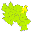
Map of Bor.PNG 582 × 638; 98 KB
-
Map of Branicevo.PNG 582 × 638; 98 KB
-
Map of Braničevo.PNG 582 × 638; 98 KB
-
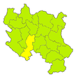
Map of Jablanica.PNG 582 × 638; 98 KB
-
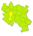
Map of Kolubara.PNG 582 × 638; 98 KB
-
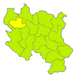
Macva.png 550 × 567; 179 KB
-
Map of Mačva.PNG 582 × 638; 98 KB
-
Map of Bor District.png 906 × 1,297; 167 KB
-
Map of Moravica.PNG 582 × 638; 98 KB
-
Map of Nišava.PNG 582 × 638; 98 KB
-
Map of Pčinja.PNG 582 × 638; 98 KB
-
Map of Pirot.PNG 582 × 638; 98 KB
-
Map of Podunavlje.PNG 582 × 638; 98 KB
-
Map of Pomoravlje.PNG 582 × 638; 98 KB
-
Map of Rasina.PNG 582 × 638; 98 KB
-
Map of Raška.PNG 582 × 638; 98 KB
-
Map of Šumadija.PNG 582 × 638; 98 KB
-
Map of Toplica.PNG 582 × 638; 98 KB
-
Map of Zaječar.PNG 582 × 638; 98 KB
-
Map of Zlatibor.PNG 582 × 638; 98 KB
-
Сербия Белград округ.png 400 × 565; 18 KB

