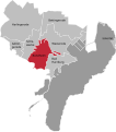
Category:Locator maps of districts of Bad Harzburg
Jump to navigation
Jump to search
Media in category "Locator maps of districts of Bad Harzburg"
The following 10 files are in this category, out of 10 total.
-
Bad Harzburg Stadtgebiet.svg 1,596 × 1,811; 48 KB
-
Bettingerode in Bad Harzburg.svg 1,596 × 1,811; 48 KB
-
Bündheim in Bad Harzburg - map.svg 1,596 × 1,811; 48 KB
-
Eckertal in Bad Harzburg.svg 1,596 × 1,811; 48 KB
-
Gut Radau in Bad Harzburg.svg 1,162 × 1,326; 114 KB
-
Göttingerode in Bad Harzburg.svg 1,596 × 1,811; 48 KB
-
Harlingerode in Bad Harzburg.svg 1,596 × 1,811; 48 KB
-
Radauanger in Bad Harzburg.svg 1,162 × 1,326; 114 KB
-
Schlewecke in Bad Harzburg.svg 1,596 × 1,811; 48 KB
-
Westerode in Bad Harzburg.svg 1,596 × 1,811; 48 KB


