Category:Locator maps of departements of Senegal
Jump to navigation
Jump to search
A "departement" is an administrative division in French. It doesn't have the same meaning than in English. Subdivision hierarchy of Senegal includes: Regions, then departements, then arrondissements.
This category currently contains:
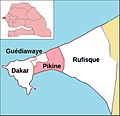
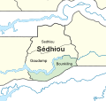
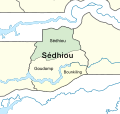
- Locator maps of departements of Senegal, within their larger region.
- Locator maps of arrondissements of Senegal, within their larger departement.
Subcategories
This category has only the following subcategory.
Media in category "Locator maps of departements of Senegal"
The following 70 files are in this category, out of 70 total.
-
Bakel arrondissements.png 1,056 × 816; 21 KB
-
Bambey arrondissements.png 1,056 × 816; 18 KB
-
Bignona arrondissements.png 1,056 × 816; 22 KB
-
Carte Guediawaye Localisation 1.jpg 689 × 666; 36 KB
-
Carte Région de Sédhiou départements.jpg 800 × 833; 58 KB
-
Dagana arrondissements.png 1,056 × 816; 18 KB
-
Dakar departments big print.png 1,056 × 816; 33 KB
-
Dakar departments.png 1,056 × 816; 20 KB
-
Dept Pikine Localisation.jpg 689 × 666; 39 KB
-
Diourbel arrondissements.png 1,056 × 816; 16 KB
-
Diourbel departments big print.png 1,056 × 816; 28 KB
-
Diourbel departments.png 1,056 × 816; 17 KB
-
Département.png 2,486 × 1,939; 182 KB
-
Fatick arrondissements.png 1,056 × 816; 21 KB
-
Fatick departments big print.png 986 × 684; 26 KB
-
Fatick departments.png 1,056 × 816; 20 KB
-
Foundiougne arrondissements.png 1,056 × 816; 21 KB
-
Gossas arrondissements.png 1,056 × 816; 18 KB
-
Guediawaye arrondissement.png 1,056 × 816; 17 KB
-
Kaffrine arrondissements.png 1,056 × 816; 19 KB
-
Kanel arrondissements.png 1,056 × 816; 20 KB
-
Kaolack arrondissements.png 1,056 × 816; 18 KB
-
Kaolack departments big print.png 1,056 × 816; 29 KB
-
Kaolack departments.png 1,056 × 816; 19 KB
-
Kebemer arrondissements.png 1,056 × 816; 19 KB
-
Kedougou arrondissements.png 1,056 × 816; 25 KB
-
Kolda arrondissements.png 1,056 × 816; 21 KB
-
Kolda departments big print.png 1,056 × 816; 33 KB
-
Kolda departments.png 1,056 × 816; 22 KB
-
Linguere arrondissements.png 1,056 × 816; 19 KB
-
Louga arrondissements.png 1,056 × 816; 21 KB
-
Louga departments big print.png 1,056 × 816; 28 KB
-
Louga departments.png 1,056 × 816; 19 KB
-
M'bour arrondissements.png 1,056 × 816; 19 KB
-
Map-dakar.svg 689 × 666; 532 KB
-
Map-fatick.svg 717 × 735; 310 KB
-
Map-ziguinchor.svg 634 × 718; 320 KB
-
Matam arrondissement.png 1,056 × 816; 19 KB
-
Matam departments big print.png 1,056 × 816; 33 KB
-
Matam departments.png 1,056 × 816; 22 KB
-
Mbacke arrondissements.png 1,056 × 816; 15 KB
-
Nioro du Rip arrondissements.png 959 × 657; 11 KB
-
Oussouye arrondissements.png 1,056 × 816; 21 KB
-
Pikine arrondissement.png 1,056 × 816; 16 KB
-
Podor arrondissements.png 1,056 × 816; 21 KB
-
Ranerou Ferlo arrondissement.png 1,056 × 816; 18 KB
-
Rufisque arrondissement.png 1,056 × 816; 16 KB
-
Saint-Louis arrondissement.png 1,056 × 816; 15 KB
-
Saint-Louis departments big print.png 1,056 × 816; 29 KB
-
Saint-Louis departments.png 1,056 × 816; 20 KB
-
Saint-louis.gif 770 × 370; 33 KB
-
Sedhiou arrondissements.png 1,056 × 816; 22 KB
-
Senegal arrondissements.png 1,281 × 880; 29 KB
-
Senegal Dak.svg 220 × 221; 1.8 MB
-
Senegal Sed Bou.svg 343 × 325; 1.42 MB
-
Senegal Sed Gou.svg 343 × 325; 1.42 MB
-
Senegal Sed Sed.svg 343 × 325; 1.42 MB
-
Senegal Sed.svg 343 × 325; 1.42 MB
-
Senegal, administrative divisions in colour 2.svg 1,264 × 947; 813 KB
-
Sénégal - Départements de Matam 2018.svg 931 × 758; 122 KB
-
Tambacounda arrondissements.png 1,056 × 816; 25 KB
-
Tambacounda departments big print.png 1,056 × 816; 36 KB
-
Tambacounda departments.png 1,056 × 816; 25 KB
-
Thies arrondissements.png 1,056 × 816; 19 KB
-
Thies departments big print.png 1,056 × 816; 28 KB
-
Thies departments.png 1,056 × 816; 20 KB
-
Tivaouane arrondissements.png 1,056 × 816; 21 KB
-
Velingara arrondissements.png 1,056 × 816; 21 KB
-
Ziguinchor arrondissements.png 1,056 × 816; 18 KB
-
Ziguinchor departments big print.png 1,056 × 816; 32 KB


