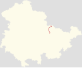
Category:Locator maps of cycling routes in Thuringia
Jump to navigation
Jump to search
Federal states of Germany:
Media in category "Locator maps of cycling routes in Thuringia"
The following 4 files are in this category, out of 4 total.
-
Positionskarte der Napoleon-1806-Radroute in Thüringen.svg 3,000 × 2,477; 482 KB
-
Positionskarte der Radroute an der Pleiße in Thüringen.svg 3,000 × 2,477; 246 KB
-
Positionskarte der Werra-Unstrut-Radroute in Thüringen.svg 3,000 × 2,476; 231 KB
-
Positionskarte des Iron Curtain Trail (ICT bzw. EV13) in Thüringen.svg 3,000 × 2,477; 327 KB


