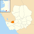
Category:Locator maps of communities in Bridgend County Borough
Jump to navigation
Jump to search
Media in category "Locator maps of communities in Bridgend County Borough"
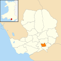
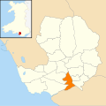
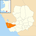
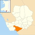
The following 22 files are in this category, out of 22 total.
-
Bridgend County Borough Wales communities - Garw Valley locator.png 980 × 955; 161 KB
-
Bridgend County Borough Wales communities - Ogmore Valley locator.png 980 × 955; 161 KB
-
Wales Bridgend Community Brackla map.svg 512 × 509; 326 KB
-
Wales Bridgend Community Bridgend map.svg 512 × 509; 326 KB
-
Wales Bridgend Community Cefn Cribwr map.svg 512 × 509; 326 KB
-
Wales Bridgend Community Coity Higher map.svg 512 × 509; 326 KB
-
Wales Bridgend Community Cornelly map.svg 512 × 509; 326 KB
-
Wales Bridgend Community Coychurch Higher map.svg 512 × 509; 326 KB
-
Wales Bridgend Community Coychurch Lower map.svg 512 × 509; 326 KB
-
Wales Bridgend Community Garw Valley map.svg 512 × 509; 326 KB
-
Wales Bridgend Community Laleston map.svg 512 × 509; 326 KB
-
Wales Bridgend Community Llangynwyd Lower map.svg 512 × 509; 326 KB
-
Wales Bridgend Community Llangynwyd Middle map.svg 512 × 509; 326 KB
-
Wales Bridgend Community Maesteg map.svg 512 × 509; 326 KB
-
Wales Bridgend Community Merthyr Mawr map.svg 512 × 509; 326 KB
-
Wales Bridgend Community Newcastle Higher map.svg 512 × 509; 326 KB
-
Wales Bridgend Community Ogmore Valley map.svg 512 × 509; 326 KB
-
Wales Bridgend Community Pencoed map.svg 512 × 509; 326 KB
-
Wales Bridgend Community Porthcawl map.svg 512 × 509; 326 KB
-
Wales Bridgend Community Pyle map.svg 512 × 509; 326 KB
-
Wales Bridgend Community St Bride's Minor map.svg 512 × 509; 326 KB
-
Wales Bridgend Community Ynysawdre map.svg 512 × 509; 326 KB


