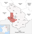
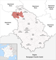
Category:Locator maps of cantons of Haute-Marne to 2018
Jump to navigation
Jump to search
Media in category "Locator maps of cantons of Haute-Marne to 2018"
The following 17 files are in this category, out of 17 total.
-
Locator map of Kanton Bologne.png 2,500 × 2,675; 1.21 MB
-
Locator map of Kanton Bourbonne-les-Bains.png 2,500 × 2,675; 1.21 MB
-
Locator map of Kanton Chalindrey.png 2,500 × 2,675; 1.21 MB
-
Locator map of Kanton Chaumont-1.png 2,500 × 2,675; 1.2 MB
-
Locator map of Kanton Chaumont-2.png 2,500 × 2,675; 1.2 MB
-
Locator map of Kanton Chaumont-3.png 2,500 × 2,675; 1.2 MB
-
Locator map of Kanton Châteauvillain.png 2,500 × 2,675; 1.21 MB
-
Locator map of Kanton Eurville-Bienville.png 2,500 × 2,675; 1.2 MB
-
Locator map of Kanton Joinville.png 2,500 × 2,675; 1.21 MB
-
Locator map of Kanton Langres.png 2,500 × 2,675; 1.2 MB
-
Locator map of Kanton Nogent.png 2,500 × 2,675; 1.21 MB
-
Locator map of Kanton Poissons.png 2,500 × 2,675; 1.21 MB
-
Locator map of Kanton Saint-Dizier-1.png 2,500 × 2,675; 1.2 MB
-
Locator map of Kanton Saint-Dizier-2.png 2,500 × 2,675; 1.2 MB
-
Locator map of Kanton Saint-Dizier-3.png 2,500 × 2,675; 1.2 MB
-
Locator map of Kanton Villegusien-le-Lac.png 2,500 × 2,675; 1.21 MB
-
Locator map of Kanton Wassy.png 2,500 × 2,675; 1.2 MB


