Category:Locator maps of boroughs of Stockholm 1998-2006
Jump to navigation
Jump to search
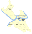
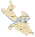
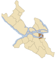
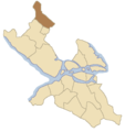
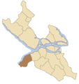
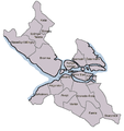
English: Maps showing the location of the boroughs of Stockholm with the borders used between 1998 and 2006, before the merger of several boroughs.
Svenska: Kartor som visar stadsdelsområdenas läge i Stockholm med gränserna som användes mellan 1998 och 2006, innan flera av stadsdelsområdena slogs samman.
Media in category "Locator maps of boroughs of Stockholm 1998-2006"
The following 24 files are in this category, out of 24 total.
-
Stockholm boroughs 1998-2006 no labels.svg 800 × 850; 40 KB
-
Stockholm boroughs 1999-2006.svg 800 × 850; 52 KB
-
Stockholms-stadsdelar.png 800 × 850; 39 KB
-
Enskede-Årsta.png 800 × 850; 27 KB
-
Stockholm boroughs 1998-2006 Enskede-Årsta.svg 800 × 850; 40 KB
-
Hägersten.png 800 × 850; 27 KB
-
Stockholm boroughs 1998-2006 Hägersten.svg 800 × 850; 40 KB
-
Katarina-Sofia.png 800 × 850; 27 KB
-
Stockholm boroughs 1998-2006 Katarina-Sofia.svg 800 × 850; 40 KB
-
Kista.png 800 × 850; 27 KB
-
Stockholm boroughs 1998-2006 Kista.svg 800 × 850; 40 KB
-
Liljeholmen map.png 800 × 850; 27 KB
-
Stockholm boroughs 1998-2006 Liljeholmen.svg 800 × 850; 40 KB
-
Maria-Gamla-stan.png 800 × 850; 27 KB
-
Stockholm boroughs 1998-2006 Maria-Gamla stan.svg 800 × 850; 40 KB
-
Rinkeby.png 800 × 850; 27 KB
-
Stockholm boroughs 1998-2006 Rinkeby.svg 800 × 850; 40 KB
-
Skärholmen.png 800 × 850; 27 KB
-
Spånga-Tensta.png 800 × 850; 27 KB
-
SwedenStockholmDistrictsmap.png 800 × 850; 44 KB
-
Stockholm boroughs 1998-2006 Vantör.svg 800 × 850; 40 KB
-
Vantör.png 800 × 850; 27 KB
-
Älvsjö.png 800 × 850; 27 KB
-
Östermalm.png 800 × 850; 27 KB

