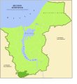
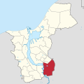
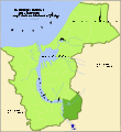
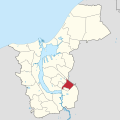
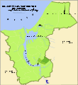
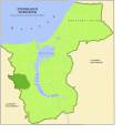
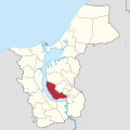
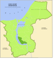
Category:Locator maps of boroughs of Rostock
Jump to navigation
Jump to search
Media in category "Locator maps of boroughs of Rostock"
The following 65 files are in this category, out of 65 total.
-
Biestow in Rostock.svg 1,380 × 1,380; 427 KB
-
Biestow.svg 2,375 × 2,594; 135 KB
-
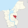
Brinckmansdorf in Rostock.svg 1,380 × 1,380; 427 KB
-
Brinckmansdorf.svg 2,375 × 2,594; 135 KB
-
Diedrichshagen in Rostock.svg 1,380 × 1,380; 427 KB
-
Dierkow in Rostock.svg 1,380 × 1,380; 427 KB
-
Dierkow-Neu in Rostock.svg 1,380 × 1,380; 427 KB
-
Dierkow-Ost in Rostock.svg 1,380 × 1,380; 427 KB
-
Dierkow-West in Rostock.svg 1,380 × 1,380; 427 KB
-
Dierkow.svg 2,375 × 2,588; 135 KB
-
Evershagen in Rostock.svg 1,380 × 1,380; 427 KB
-
Evershagen.svg 2,375 × 2,594; 135 KB
-
Gartenstadt-Stadtweide in Rostock.svg 1,380 × 1,380; 427 KB
-
Gehlsdorf in Rostock.svg 1,380 × 1,380; 427 KB
-
Gehlsdorf.svg 2,375 × 2,594; 135 KB
-
Groß Klein in Rostock.svg 1,380 × 1,380; 427 KB
-
Groß Klein.svg 2,375 × 2,594; 135 KB
-
Hansaviertel in Rostock.svg 1,380 × 1,380; 427 KB
-
Hinrichsdorf in Rostock.svg 1,380 × 1,380; 427 KB
-
Hinrichsdorf.svg 2,375 × 2,594; 135 KB
-
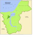
Rostock Ortsteile Hinrichshagen.PNG 706 × 788; 65 KB
-
Hinrichshagen in Rostock.svg 1,380 × 1,380; 427 KB
-
Hinrichshagen.svg 2,375 × 2,594; 135 KB
-
Hohe Düne in Rostock.svg 1,380 × 1,380; 427 KB
-
Hohe Düne.svg 2,375 × 2,594; 135 KB
-
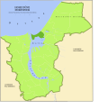
Rostock Ortsteile Hohe Düne.PNG 706 × 788; 66 KB
-
Jürgeshof in Rostock.svg 1,380 × 1,380; 427 KB
-
Jürgeshof.svg 2,375 × 2,594; 135 KB
-
Kröpeliner-Tor-Vorstadt in Rostock.svg 1,380 × 1,380; 427 KB
-
Kröpeliner-Tor-Vorstadt.svg 2,375 × 2,594; 135 KB
-
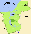
Rostock Ortsteile KTV.PNG 706 × 788; 66 KB
-
Krummendorf in Rostock.svg 1,380 × 1,380; 427 KB
-
Krummendorf Rostock.svg 2,375 × 2,594; 135 KB
-
Rostock Ortsteile Lichtenhagen.PNG 706 × 788; 66 KB
-
Lichtenhagen in Rostock.svg 1,380 × 1,380; 427 KB
-
Lichtenhagen.svg 2,375 × 2,594; 135 KB
-
Rostock Ortsteile Lütten Klein.PNG 706 × 788; 66 KB
-
Lütten Klein in Rostock.svg 1,380 × 1,380; 427 KB
-
Lütten Klein.svg 2,375 × 2,594; 135 KB
-
Markgrafenheide in Rostock.svg 1,380 × 1,380; 427 KB
-
Markgrafenheide.svg 2,375 × 2,594; 135 KB
-
Nienhagen in Rostock.svg 1,380 × 1,380; 427 KB
-
Nienhagen.svg 2,375 × 2,594; 135 KB
-
Rostock Ortsteile Peez.PNG 706 × 788; 64 KB
-
Peez in Rostock.svg 1,380 × 1,380; 427 KB
-
Peez.svg 2,375 × 2,594; 135 KB
-
Rostock Ortsteile Reutershagen.PNG 706 × 788; 66 KB
-
Reutershagen in Rostock.svg 1,380 × 1,380; 427 KB
-
Reutershagen.svg 2,375 × 2,594; 135 KB
-
Rostock Ortsteile Schmarl.PNG 706 × 788; 65 KB
-
Schmarl in Rostock.svg 1,380 × 1,380; 427 KB
-
Schmarl.svg 2,375 × 2,594; 135 KB
-
Stadtmitte in Rostock.svg 1,380 × 1,380; 427 KB
-
Stuthof in Rostock.svg 1,380 × 1,380; 427 KB
-
Stuthof Rostock.svg 2,375 × 2,594; 135 KB
-
Südstadt in Rostock.svg 1,380 × 1,380; 427 KB
-
Südstadt Rostock.svg 2,375 × 2,594; 135 KB
-
Toitenwinkel in Rostock.svg 1,380 × 1,380; 427 KB
-
Toitenwinkel.svg 2,375 × 2,594; 135 KB
-
Torfbrücke in Rostock.svg 1,380 × 1,380; 427 KB
-
Torfbrücke.svg 2,375 × 2,594; 135 KB
-
Unmarkierte Map Rostock.svg 1,380 × 1,380; 427 KB
-
Seebad Warnemünde in Rostock.svg 1,380 × 1,380; 427 KB
-
Warnemünde.svg 2,375 × 2,588; 135 KB
-
Wiethagen in Rostock.svg 1,380 × 1,380; 427 KB

