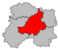
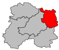
Category:Locator maps of arrondissements of Marne to 2017
Jump to navigation
Jump to search
Media in category "Locator maps of arrondissements of Marne to 2017"
The following 15 files are in this category, out of 15 total.
-
Locator map of Arrondissement Châlons-en-Champagne 2017.png 2,500 × 1,843; 1.66 MB
-
Locator map of Arrondissement Épernay 2017.png 2,500 × 1,843; 1.67 MB
-
Map arrondissement code 511.svg 535 × 447; 7 KB
-
Map arrondissement code 512.svg 535 × 447; 7 KB
-
Map arrondissement code 513.svg 535 × 447; 7 KB
-
Map arrondissement code 514.svg 535 × 447; 7 KB
-
Map arrondissement code 515.svg 535 × 447; 7 KB
-
Marne - Châlons-en-Champagne arrondissement.svg 512 × 424; 14 KB
-
Marne - Reims arrondissement.svg 512 × 424; 14 KB
-
Marne - Sainte-Menehould arrondissement.svg 512 × 424; 14 KB
-
Marne - Vitry-le-François arrondissement.svg 512 × 424; 14 KB
-
Marne - Épernay arrondissement.svg 512 × 424; 14 KB
-
Locator map of Arrondissement Reims 2017.png 2,500 × 1,843; 1.66 MB
-
Locator map of Arrondissement Sainte-Menehould 2017.png 2,500 × 1,843; 1.66 MB
-
Locator map of Arrondissement Vitry-le-François 2017.png 2,500 × 1,843; 1.66 MB


