Category:Locator maps of area municipalities in Saxony-Anhalt
Jump to navigation
Jump to search
Federal states of Germany:
Subcategories
This category has only the following subcategory.
Media in category "Locator maps of area municipalities in Saxony-Anhalt"
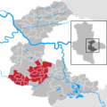
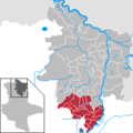
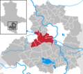
The following 15 files are in this category, out of 15 total.
-
Verbandsgemeinde Arneburg-Goldbeck in SDL.png 299 × 299; 5 KB
-
VG Bitterfeld-Wolfen in ABI.png 299 × 299; 5 KB
-
VG Elbe-Ehle-Nuthe in ABI.png 299 × 299; 5 KB
-
Verbandsgemeinde Elbe-Havel-Land in SDL.png 299 × 299; 5 KB
-
VG Möckern-Loburg-Fläming in JL.png 299 × 299; 12 KB
-
VG Muldestausee-Schmerzbach in ABI.png 299 × 299; 5 KB
-
VG Osternienburg in ABI.png 299 × 299; 5 KB
-
VG Östlicher Saalkreis in SK.png 299 × 266; 5 KB
-
VG Raguhn in ABI.png 299 × 299; 5 KB
-
VG Saalkreis Nord in SK.png 299 × 266; 5 KB
-
Verbandsgemeinde Seehausen (Altmark) in SDL.png 299 × 299; 5 KB
-
VG Südliches Anhalt in ABI.png 299 × 299; 6 KB
-
VG Tangerhütte-Land in SDL.png 299 × 299; 6 KB
-
Verbandsgemeinde Weida-Land in SK.png 299 × 266; 5 KB
-
VG Würde-Salza in SK.png 299 × 266; 6 KB
