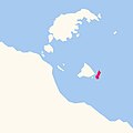
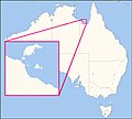
Category:Locator maps of Wellesley Islands
Jump to navigation
Jump to search
Media in category "Locator maps of Wellesley Islands"
The following 13 files are in this category, out of 13 total.
-
Locator map of Allen Island.jpg 542 × 543; 45 KB
-
Locator map of Bayley Island.jpg 542 × 543; 45 KB
-
Locator map of Bentinck Island.jpg 542 × 543; 46 KB
-
Locator map of Denham Island.jpg 542 × 543; 45 KB
-
Locator map of Forsyth Island.jpg 542 × 543; 46 KB
-
Locator map of Fowler Island.jpg 542 × 543; 45 KB
-
Locator map of Horseshoe Island.jpg 542 × 543; 45 KB
-
Locator map of Mornington Island.jpg 542 × 543; 48 KB
-
Locator map of Pains Island.jpg 542 × 543; 45 KB
-
Locator map of Sweers Island.jpg 542 × 543; 45 KB
-
Locator map of Sydney Island.jpg 542 × 543; 45 KB
-
South Wellesley Islands locator map.jpg 1,500 × 1,355; 576 KB
-
Wellesley Islands locator map.jpg 1,500 × 1,355; 573 KB


