Category:Locator maps of Somalia
Jump to navigation
Jump to search
Subcategories
This category has the following 3 subcategories, out of 3 total.
!
B
- Bilateral maps of Somalia (61 F)
Media in category "Locator maps of Somalia"
The following 19 files are in this category, out of 19 total.
-
Ayn somalia province.png 426 × 585; 21 KB
-
Baidoa karte.JPG 300 × 215; 20 KB
-
Central Somalia.png 424 × 600; 28 KB
-
Dagmada Burdhubo.jpg 438 × 557; 21 KB
-
Dagmada Celcade.jpg 471 × 556; 22 KB
-
Galkacyo karte.JPG 250 × 184; 18 KB
-
KhatumoStatemap.png 240 × 320; 16 KB
-
Location Somalia AW.png 385 × 238; 10 KB
-
LocationwesternSomalia.PNG 250 × 125; 17 KB
-
Map Jilib.png 291 × 371; 71 KB
-
Map of Somalia (1962).png 480 × 438; 17 KB
-
Map of Somalia (1970).png 453 × 448; 22 KB
-
Map of Somalia.svg 674 × 851; 203 KB
-
Puntie.png 608 × 598; 211 KB
-
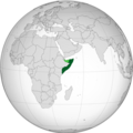
Somalia (orthographic projection) highlighted.svg 550 × 550; 426 KB
-
Somalia (orthographic projection).png 1,106 × 1,106; 441 KB
-
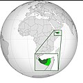
Somalia with disputed territory highlighted (orthographic projection).jpg 1,010 × 1,016; 174 KB
-
Somaliland ortographic map.jpg 1,080 × 1,079; 181 KB
-
The federal republic of Somalia.png 600 × 600; 116 KB


