Category:Locator maps of New Zealand
Jump to navigation
Jump to search
Subcategories
This category has the following 11 subcategories, out of 11 total.
!
*
+
B
L
P
Media in category "Locator maps of New Zealand"
The following 68 files are in this category, out of 68 total.
-
Akaroa.png 239 × 302; 16 KB
-
Antarctica, New Zealand territorial claim.svg 806 × 806; 63 KB
-
Auckland Central 2008 2011 NZ electorate.svg 489 × 528; 438 KB
-
Brunner.png 150 × 209; 6 KB
-
Castlepointmap.png 860 × 860; 23 KB
-
Champagne Pool Map.jpg 829 × 692; 161 KB
-
Clutha-Southland 2008 2011 NZ electorate.svg 489 × 528; 438 KB
-
Dunedin.png 456 × 599; 37 KB
-
GunnMap Icon.png 128 × 128; 8 KB
-
GunnMap Icon.svg 300 × 300; 14 KB
-
Helensville 2008 2011 NZ electorate.svg 489 × 528; 437 KB
-
Iles Mercure.png 1,000 × 600; 34 KB
-
Iwi map Ngati Mahuta.jpg 661 × 398; 47 KB
-
Kaiwera downs wind farm transmission line route.png 2,468 × 1,732; 6.17 MB
-
Kelburn.png 650 × 870; 247 KB
-
Leiopelmatidae range zoomed.png 411 × 585; 13 KB
-
LocationNewZealand.png 435 × 200; 35 KB
-
LocMap Tongariro National Park2.png 800 × 590; 8 KB
-
MiTasmanNelson.png 386 × 556; 9 KB
-
MiTauihu.png 386 × 556; 9 KB
-
Neuseeland-Pos.png 330 × 228; 16 KB
-
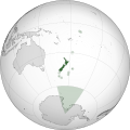
New Zealand (orthographic projection) 2.svg 550 × 550; 292 KB
-
New Zealand (orthographic projection).svg 541 × 541; 276 KB
-
New Zealand - Location Map (2013) - NZL - UNOCHA.svg 250 × 250; 666 KB
-
New Zealand India Locator.svg 940 × 415; 1.76 MB
-
New Zealand-Canada relations map2.PNG 1,425 × 625; 57 KB
-
NgatiKahungunu1.jpg 695 × 794; 40 KB
-
North Island New Zealand.png 1,928 × 2,432; 326 KB
-
Northland 2008 2011 NZ Electorate.svg 489 × 528; 463 KB
-
Novozelandske kralovstvi.jpg 1,000 × 1,000; 84 KB
-
NZ Domt Network.jpg 350 × 264; 7 KB
-
NZ Embassies 1945.png 1,357 × 628; 39 KB
-
NZ Embassies 1960.png 1,357 × 628; 40 KB
-
NZ Embassies 1975.png 1,357 × 628; 41 KB
-
NZ Embassies 1990.png 1,357 × 628; 41 KB
-
NZ Embassies 2005.png 1,357 × 628; 43 KB
-
NZ Embassies.png 1,357 × 628; 54 KB
-
NZ Intl Network.jpg 800 × 397; 36 KB
-
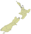
Nz map bay of islands.jpg 330 × 485; 11 KB
-
Nz map coromandel.gif 330 × 485; 4 KB
-
Nz map ninety mile beach.gif 330 × 485; 4 KB
-
Nz map northland.gif 330 × 485; 4 KB
-
Nz map rotorua.gif 330 × 485; 4 KB
-
NZ Realm of New Zealand.png 1,357 × 617; 38 KB
-
NZ-Cape Runaway.png 413 × 600; 27 KB
-
NZ-Kurow.png 405 × 590; 11 KB
-
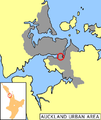
NZ-Otahuhu.png 589 × 701; 104 KB
-
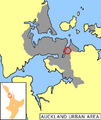
NZ-Pakuranga.png 589 × 701; 104 KB
-
NZ-Papatoetoe.png 589 × 701; 104 KB
-
NZ-SH1 map.png 405 × 590; 40 KB
-
NZ-SH15A-map.png 492 × 573; 36 KB
-
NZAcrididae6.png 801 × 1,000; 358 KB
-
NZCentralPoliceDist.jpg 385 × 556; 31 KB
-
NZL orthographic NaturalEarth.svg 512 × 512; 574 KB
-
NZLrealms-rus.jpg 1,112 × 1,416; 284 KB
-
NZVISAFREEACCESS2.PNG 800 × 351; 94 KB
-
Paparoa National Park.png 405 × 590; 7 KB
-
Pisa Range, New Zealand.png 2,481 × 3,506; 76 KB
-
Queen Charlotte Sound (New Zeeland) 2.jpg 483 × 541; 33 KB
-
Queen Charlotte Sound (New Zeeland).jpg 483 × 541; 30 KB
-
Realm of New Zealand Exclusive Economic Zones.png 2,401 × 1,045; 151 KB
-
South East Australia and New Zealand locator map.png 682 × 512; 29 KB
-
South Island New Zealand.png 1,928 × 2,432; 322 KB
-
Terytoria zależne Nowej Zelandii.png 2,236 × 1,376; 420 KB
-
Tukituki 2008 2011 NZ electorate.svg 489 × 528; 431 KB
-
Whakatu.png 405 × 590; 10 KB
-
World Factbook (1982) New Zealand.jpg 587 × 585; 84 KB
-
Yeni zelanda cb.png 581 × 474; 10 KB


