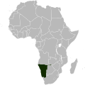
Category:Locator maps of Namibia
Jump to navigation
Jump to search
Subcategories
This category has only the following subcategory.
!
Media in category "Locator maps of Namibia"
The following 14 files are in this category, out of 14 total.
-
East-Africa (Namibia-2).png 585 × 600; 73 KB
-
Four O Regions in Namibia.png 975 × 900; 102 KB
-
Kaart vun Namibia mat Lag vu Windhoek.gif 200 × 183; 10 KB
-
Karte Namibia-Pos.png 330 × 299; 14 KB
-
Location Namibia AU Africa.svg 1,400 × 1,300; 1.64 MB
-
LocationNamibia.png 250 × 115; 5 KB
-
LocationNamibia.svg 1,000 × 500; 2.76 MB
-
LocationSouthAfrica (1915–1990).svg 1,000 × 500; 2.76 MB
-
Locator map of Namibia in Africa.svg 1,000 × 1,000; 188 KB
-
Namibia (orthographic projection).svg 550 × 550; 184 KB
-
NamibiaEtosha.jpg 547 × 488; 43 KB
-
República de Sudáfrica 1961-1990.png 550 × 550; 90 KB
-
Wahlkreis Daweb in Hardap.png 975 × 900; 150 KB
-
Wahlkreis Karasburg-West in Karas.png 975 × 900; 153 KB


