Category:Locator maps of Montevideo Department
Jump to navigation
Jump to search
Media in category "Locator maps of Montevideo Department"
The following 29 files are in this category, out of 29 total.
-
 Montevideo in Uruguay.svg 1,000 × 1,056; 184 KB
-
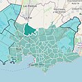
 Uruguay Montevideo map.svg 1,000 × 1,056; 117 KB
-
 Uruguay-Montevideo.svg 908 × 1,004; 96 KB
-
 1830 Uruguay Montevideo map.PNG 1,000 × 1,056; 122 KB
-
 Avenida Luis Braille (Montevideo).png 1,018 × 720; 71 KB
-
 Belvedere mapa.jpg 1,080 × 1,079; 238 KB
-
 Colón mapa.jpg 1,080 × 1,079; 240 KB
-
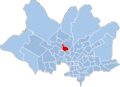
 Conciliación map.png 1,154 × 838; 104 KB
-
 Joanicó mapa.jpg 1,080 × 1,079; 235 KB
-
 Lezica mapa.jpg 1,080 × 1,079; 243 KB
-
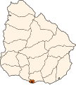
 Location department Montevideo(Uruguay).png 248 × 304; 6 KB
-
 Mapa de Carrasco Norte.jpg 1,080 × 1,079; 129 KB
-
 Mapa de Carrasco.jpg 1,080 × 1,079; 128 KB
-
 Mapa de Colón.jpg 1,080 × 1,079; 122 KB
-
 Mapa de La Paloma.jpg 1,080 × 1,079; 127 KB
-
 Mapa de La Teja.jpg 1,080 × 1,079; 130 KB
-
 Mapa de Paso de las Duranas.jpg 1,080 × 1,079; 121 KB
-
 Mapa de Peñarol.jpg 1,080 × 1,079; 124 KB
-
 Mapa de Punta Gorda.jpg 1,080 × 1,079; 124 KB
-
 Mapa de Sayago.jpg 1,080 × 1,079; 119 KB
-
 Nuevo París mapa.jpg 1,080 × 1,079; 232 KB
-
 Peñarol mapa.jpg 1,080 × 1,079; 239 KB
-
 Prado mapa.jpg 1,080 × 1,079; 233 KB
-
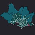
 Sayago map.png 1,154 × 838; 108 KB
-
 Sayago mapa.jpg 1,080 × 1,079; 241 KB
-
 Sayago Norte Map.png 1,154 × 838; 105 KB
-
 SAYAGO NORTE PREESTABLECIDO.jpg 1,080 × 1,075; 248 KB
-
 SAYAGO NORTE.jpg 1,080 × 1,072; 246 KB
-
 Uruguay-Montevideo.png 200 × 219; 5 KB


.png)


.png)


