Category:Locator maps of Mexican islands
Jump to navigation
Jump to search
Media in category "Locator maps of Mexican islands"
The following 21 files are in this category, out of 21 total.
-
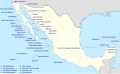 Islands of Mexico.svg 2,159 × 1,326; 474 KB
-
 09E 2010 5day.gif 895 × 716; 19 KB
-
 Mexico - Cedros.PNG 534 × 484; 32 KB
-
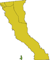 Cedros BC.PNG 438 × 517; 10 KB
-
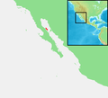
 Coronado Islands Map.jpg 1,266 × 877; 129 KB
-
 Cozumel location map.svg 745 × 819; 136 KB
-
 Isla Mujeres location map.svg 799 × 833; 36 KB
-
 Islas Marias Nayarit.png 453 × 317; 5 KB
-
 Mexico - Marias.PNG 534 × 484; 32 KB
-
 Mexico - Guadalupe.PNG 534 × 484; 32 KB
-
 Mexico - Isla Ángel de la Guarda.PNG 534 × 484; 32 KB
-
 Mexico - Tiburón Island.PNG 534 × 484; 32 KB
-
 Mexico Cozumel relief location map.svg 360 × 396; 430 KB
-
 Mexico Islas Marías location map.svg 719 × 700; 36 KB
-
 MX-Revillagigedo.PNG 500 × 500; 10 KB
-
 Revillagigedo Islands - Clarión.PNG 534 × 484; 32 KB
-
 Revillagigedo Islands - San Benedicto.PNG 534 × 484; 32 KB
-
 Revillagigedo Islands - Socorro.PNG 534 × 484; 32 KB
-
 Revillagigedo Islands.PNG 534 × 484; 33 KB
-
 Revillagigedo kaart.PNG 254 × 196; 9 KB
-
 Rocas Alijos-map.png 390 × 399; 457 KB


