Category:Locator maps of Lanzarote
Jump to navigation
Jump to search
Islands of the Canary Islands: Fuerteventura · La Gomera · Gran Canaria · El Hierro · Lanzarote · La Palma · Tenerife
Subcategories
This category has the following 2 subcategories, out of 2 total.
!
M
Media in category "Locator maps of Lanzarote"
The following 24 files are in this category, out of 24 total.
-
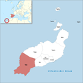
Karte Gemeinde Arrecife 2022.png 3,000 × 2,989; 509 KB
-
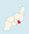
Arrecife.png 223 × 293; 14 KB
-
ES Chinijo.PNG 500 × 413; 7 KB
-
Karte Gemeinde Haría 2022.png 3,000 × 2,989; 507 KB
-
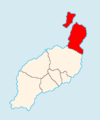
Haría.png 223 × 293; 14 KB
-
ES Lanzarote.PNG 500 × 413; 6 KB
-
LZ Arrecife.png 224 × 269; 2 KB
-
LZ Haria.png 224 × 269; 2 KB
-
LZ SanBartolome.png 224 × 269; 2 KB
-
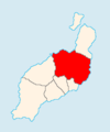
LZ Teguise.png 224 × 269; 2 KB
-
LZ Tias.png 224 × 269; 2 KB
-
LZ Tinajo.png 224 × 269; 2 KB
-
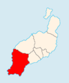
LZ Yaiza.png 224 × 269; 2 KB
-
Mapa Canarias Lanzarote.svg 977 × 410; 27 KB
-
Karte Gemeinde San Bartolomé 2022.png 3,000 × 2,989; 509 KB
-
San Bartolomé.png 223 × 293; 14 KB
-
Karte Gemeinde Teguise 2022.png 3,000 × 2,989; 506 KB
-
Teguise.png 223 × 293; 15 KB
-
Karte Gemeinde Tinajo 2022.png 3,000 × 2,989; 508 KB
-
Tinajo.png 223 × 293; 14 KB
-
Karte Gemeinde Tías 2022.png 3,000 × 2,989; 508 KB
-
Tías.png 223 × 293; 14 KB
-
Karte Gemeinde Yaiza 2022.png 3,000 × 2,989; 507 KB
-
Yaiza.png 223 × 293; 14 KB


