Category:Locator maps of French islands
Jump to navigation
Jump to search
Subcategories
This category has the following 3 subcategories, out of 3 total.
C
Media in category "Locator maps of French islands"
The following 26 files are in this category, out of 26 total.
-
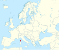
Corsica in Europe.svg 1,401 × 1,198; 949 KB
-
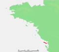
FR Belle Ile.PNG 650 × 582; 17 KB
-
FR Hoedic.PNG 650 × 582; 17 KB
-
FR Houat.PNG 650 × 582; 17 KB
-
FR Ile aux Moines.PNG 650 × 582; 17 KB
-
FR Ile d Arz.PNG 650 × 582; 17 KB
-
FR Ile d Oleron.PNG 650 × 582; 17 KB
-
FR Ile d Yeu.PNG 650 × 582; 17 KB
-
FR Ile de Aix.PNG 650 × 582; 17 KB
-
FR Ile de Batz.PNG 650 × 582; 17 KB
-
FR Ile de Brehat.PNG 650 × 582; 17 KB
-
FR Ile de Groix.PNG 650 × 582; 17 KB
-
FR Ile de Noirmoutier.PNG 650 × 582; 17 KB
-
FR Ile de Re.PNG 650 × 582; 17 KB
-
FR Ile Madame.PNG 650 × 582; 9 KB
-
FR Ile Molene.PNG 650 × 582; 17 KB
-
FR Ille de Sein.PNG 650 × 582; 17 KB
-
FR Les Sept Iles.PNG 650 × 582; 17 KB
-
FR Quessant.PNG 650 × 582; 17 KB
-
MZ Glorioso.PNG 906 × 501; 14 KB
-
Houat en bretagne 2.jpg 374 × 245; 20 KB
-
Houatenbretagne.jpg 998 × 653; 76 KB
-
France - Iles Hyeres.PNG 551 × 433; 140 KB
-
France - Lavezzi.PNG 392 × 468; 76 KB
-
Localisation-Ouessant.png 250 × 115; 15 KB
-
NieuwCaledonieLocatie.png 250 × 115; 4 KB
