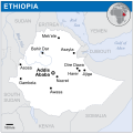
Category:Locator maps of Ethiopia
Jump to navigation
Jump to search
Subcategories
This category has the following 2 subcategories, out of 2 total.
!
B
- Bilateral maps of Ethiopia (63 F)
Media in category "Locator maps of Ethiopia"
The following 16 files are in this category, out of 16 total.
-
Afar Region.svg 512 × 414; 516 KB
-
Aussa-modern (Africa orthographic projection).png 2,048 × 2,048; 700 KB
-
Ethiopia (orthographic projection).png 800 × 800; 261 KB
-
Ethiopia - Location Map (2013) - ETH - UNOCHA.svg 254 × 255; 419 KB
-
Ethiopia Locator map.png 541 × 647; 15 KB
-
Grand-Ethiopian dam.jpg 656 × 339; 43 KB
-
Localisation Ethiopie.png 550 × 550; 129 KB
-
Locator EG-SD-ET.png 300 × 200; 19 KB
-
LocMap of WH Aksum.png 275 × 288; 5 KB
-
LocMap of WH Awash.png 275 × 288; 5 KB
-
Tigray Region in Ethiopia.svg 512 × 414; 516 KB
-
Tigray Region.svg 512 × 414; 516 KB
-
TR region.svg 512 × 414; 516 KB
-
Wiki map 梅拉羅.png 740 × 600; 101 KB
-
World Factbook (1982) Ethiopia.jpg 583 × 585; 90 KB
-
ЭфиопияКартаСепаратизм.jpg 2,048 × 2,048; 473 KB


