Category:Locator maps of Botswana
Jump to navigation
Jump to search
Subcategories
This category has the following 2 subcategories, out of 2 total.
B
- Bilateral maps of Botswana (37 F)
S
Media in category "Locator maps of Botswana"
The following 17 files are in this category, out of 17 total.
-
 Botswana (centered orthographic projection).svg 550 × 550; 365 KB
-
 Botswana - Location Map (2013) - BWA - UNOCHA hu.svg 250 × 250; 285 KB
-
 Botswana - Location Map (2013) - BWA - UNOCHA.svg 250 × 250; 279 KB
-
 Botswana in au.png 2,000 × 2,000; 537 KB
-
 Burkina Faso - Location Map (2013) - BFA - UNOCHA smn.svg 250 × 250; 275 KB
-
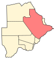 Central District, Botswana.svg 2,000 × 2,122; 63 KB
-
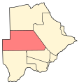 Ghanzi District, Botswana.svg 2,000 × 2,122; 63 KB
-
 Kgalagadi District, Botswana.svg 2,000 × 2,122; 63 KB
-
 Kgatleng District, Botswana.svg 2,000 × 2,122; 63 KB
-
 Kweneng District, Botswana.svg 2,000 × 2,122; 63 KB
-
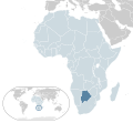 Location Botswana AU Africa.svg 1,400 × 1,300; 2.17 MB
-
 LocationBotswana.png 250 × 115; 5 KB
-
 Mapa BW.svg 1,000 × 1,000; 188 KB
-
 North-East District, Botswana.svg 2,000 × 2,122; 63 KB
-
 North-West District, Botswana.svg 2,000 × 2,122; 63 KB
-
 South-East District, Botswana.svg 2,000 × 2,122; 63 KB
-
 Southern District, Botswana.svg 2,000 × 2,122; 63 KB
.svg)
_-_BWA_-_UNOCHA_hu.svg)
_-_BWA_-_UNOCHA.svg)

_-_BFA_-_UNOCHA_smn.svg)


