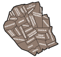
Category:Locator maps of Białołęka
Jump to navigation
Jump to search
Media in category "Locator maps of Białołęka"
The following 18 files are in this category, out of 18 total.
-
DZIELNICA BIAŁOŁĘKA OSIEDLA.jpg 1,000 × 732; 59 KB
-
Historyczna mapa bialoleki.svg 800 × 744; 55 KB
-
Osiedla Białołęki.svg 950 × 744; 72 KB
-
Osiedla dzielnicy Białołęka (Warszawa).png 4,961 × 3,508; 1.71 MB
-
PL warsaw białołęka dworska location.svg 950 × 744; 14 KB
-
PL Warsaw białołęka location.svg 655 × 760; 27 KB
-
PL Warsaw BIAŁOŁĘKA MSI podział.svg 950 × 744; 14 KB
-
PL warsaw brzeziny location.svg 950 × 744; 14 KB
-
PL warsaw choszczówka location.svg 950 × 744; 14 KB
-
PL warsaw dąbrówka szlachecka location.svg 950 × 744; 14 KB
-
PL warsaw grodzisk location.svg 950 × 744; 14 KB
-
PL warsaw henryków location.svg 950 × 744; 14 KB
-
PL warsaw kobiałka location.svg 950 × 744; 14 KB
-
PL warsaw nowodwory location.svg 950 × 744; 14 KB
-
PL warsaw szamocin location.svg 950 × 744; 14 KB
-
PL warsaw tarchomin location.svg 950 × 744; 14 KB
-
PL warsaw żerań location.svg 950 × 744; 14 KB
-
ZERAN wg MSI-1.jpg 500 × 407; 20 KB


