Category:Locator maps of Australia
Jump to navigation
Jump to search
Subcategories
This category has the following 6 subcategories, out of 6 total.
!
S
V
Media in category "Locator maps of Australia"
The following 60 files are in this category, out of 60 total.
-
Austraalia-manner.png 360 × 184; 16 KB
-
Australia - Location Map (2013) - AUS - UNOCHA.svg 250 × 250; 945 KB
-
Australia Hobart Brighton locator map.svg 1,131 × 1,250; 275 KB
-
Australia locator ACT.png 938 × 878; 43 KB
-
Australia locator Adelaide.png 210 × 196; 10 KB
-
Australia Locator Blank.svg 290 × 262; 126 KB
-
Australia Locator Map (alt).svg 331 × 320; 75 KB
-
Australia Locator Map.svg 290 × 262; 67 KB
-
Australia locator NSW.png 938 × 878; 43 KB
-
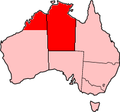
Australia locator NT.png 938 × 878; 43 KB
-
Australia locator Qld.png 938 × 878; 44 KB
-
Australia locator SA.png 938 × 878; 43 KB
-
Australia locator Tas.png 938 × 878; 43 KB
-
Australia locator Vic.png 938 × 878; 43 KB
-
Australia locator WA.png 938 × 878; 44 KB
-
Australia Locator.PNG 331 × 320; 3 KB
-
Australia medium-res locator map.svg 1,000 × 921; 876 KB
-
Australia Perth Embleton locator map.svg 1,250 × 874; 417 KB
-
Australia SA locator Adelaide.png 169 × 196; 7 KB
-
Australia SA locator Adelaide2.png 210 × 196; 10 KB
-
Australia Tasmania Brighton locator map.svg 1,030 × 1,250; 2.65 MB
-
Australia Victoria Baw Baw Shire Warragul locator map.svg 1,123 × 1,250; 693 KB
-
Australia Western Australia Bayswater City Embleton locator map.svg 773 × 1,250; 106 KB
-
Australian external territories-hy.png 644 × 376; 14 KB
-
AustraliaWestAsiaMap.png 443 × 627; 10 KB
-
AustraliaWorldMap.png 1,427 × 628; 86 KB
-
Avustralya cb.png 926 × 824; 33 KB
-
Blue Lake location map.jpg 454 × 600; 60 KB
-
City locator blank-MJC.png 230 × 194; 4 KB
-
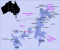
Cooper Basin Geological Map.png 655 × 606; 580 KB
-
Darwin locator-MJC.png 563 × 476; 12 KB
-
FnqrAO.png 200 × 186; 13 KB
-
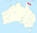
Great Barrier Reef Marine Park locator map.svg 2,055 × 1,846; 347 KB
-
Griffith, australia.PNG 678 × 671; 118 KB
-
Hobart Tasmania.png 600 × 450; 86 KB
-
Kuranda locator-MJC.png 563 × 476; 14 KB
-
Location kimberley.png 329 × 352; 39 KB
-
LocationAU.png 251 × 161; 6 KB
-
LocationAustralia with inset.png 250 × 115; 6 KB
-
LocationAustraliaGreen.svg 2,751 × 1,398; 326 KB
-
LocMap of Shark Bay.png 325 × 248; 18 KB
-
LocMap of WH - Australia.png 325 × 248; 18 KB
-
LocMap of WH - Autraria 2.PNG 284 × 217; 11 KB
-
LocMap of WH AMFS.png 325 × 248; 19 KB
-
LocMap OrganPipes.png 190 × 285; 4 KB
-
Map of the Cooper Basin.jpg 2,433 × 2,528; 1.15 MB
-
Map PIF.JPG 486 × 304; 42 KB
-
Michelago, Australia.PNG 652 × 668; 133 KB
-
Mont Bogong.png 576 × 482; 134 KB
-
NorforceAO.PNG 200 × 186; 13 KB
-
Oceania simon.png 273 × 227; 6 KB
-
Palmerston City LGA.gif 248 × 329; 13 KB
-
Perry Island, Australia, on map.png 834 × 750; 191 KB
-
Skylab reentry map.svg 512 × 448; 173 KB
-
South East Australia and New Zealand locator map.png 682 × 512; 29 KB
-
The Outback Locator map.png 1,024 × 920; 155 KB
-
Toowoomba locator-MJC.png 563 × 476; 12 KB
-
Uluru-chizu.gif 620 × 320; 7 KB
-
Восточная Австралия.png 563 × 476; 21 KB
-
Таун оф Алис-Спрингс.jpg 354 × 599; 31 KB


