Category:Locator maps of Antarctica (gray scheme)
Jump to navigation
Jump to search
Subcategories
This category has the following 4 subcategories, out of 4 total.
Media in category "Locator maps of Antarctica (gray scheme)"
The following 13 files are in this category, out of 13 total.
-
Antarctica land claim map.png 561 × 471; 18 KB
-
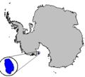
Antarctica Peter I Island.png 300 × 275; 3 KB
-
Antarctica territorial claims.png 1,432 × 768; 41 KB
-
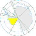
Antarctica, neutral zone(yellow).gif 250 × 250; 8 KB
-
Antarctican bases.png 1,357 × 628; 36 KB
-
Carney Island Antarctica.png 300 × 275; 3 KB
-
Dumont d'Urville-pos.png 2,380 × 1,978; 171 KB
-
Image Siple Island Antarctica.png 300 × 275; 3 KB
-
Moa iceshelves.jpg 348 × 273; 25 KB
-
Roosevelt Island Antarctica.png 300 × 275; 3 KB
-
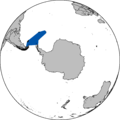
Scotia Sea.png 726 × 726; 10 KB
-
TerreAdelie.png 2,380 × 1,978; 196 KB
-
Thurston Island Antarctica.png 300 × 275; 3 KB


