Category:Locator maps of Antarctica (globe scheme)
Jump to navigation
Jump to search
Subcategories
This category has the following 4 subcategories, out of 4 total.
Media in category "Locator maps of Antarctica (globe scheme)"
The following 35 files are in this category, out of 35 total.
-
Antarktis 4.png 487 × 486; 40 KB
-
AntDotMap Belgrano II.png 439 × 439; 19 KB
-
AntDotMap Jubany.png 439 × 439; 55 KB
-
AntDotMap Orcadas.png 439 × 439; 45 KB
-
AntDotMap Rothera.png 200 × 200; 19 KB
-
Axel Heiberg Glacier.png 488 × 487; 22 KB
-
Beardmore Glacier.png 488 × 487; 22 KB
-
Caird Coast.png 488 × 487; 22 KB
-
Cape Denison.png 488 × 487; 22 KB
-
Cape Gray.png 488 × 487; 22 KB
-
Cape Philippi.png 488 × 487; 21 KB
-
Cape Reynolds.png 488 × 487; 21 KB
-
Commonwealth Bay.png 488 × 487; 22 KB
-
David glacier.png 488 × 487; 21 KB
-
Distrsheath.png 726 × 726; 29 KB
-
Distrsheath2.png 726 × 726; 41 KB
-
Drygalski Glacier.png 488 × 487; 21 KB
-
Farthest South base map.png 439 × 439; 43 KB
-
Farthest South map.png 439 × 439; 44 KB
-
Ferrar Glacier.png 488 × 487; 22 KB
-
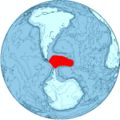
La Antártida en el mundo.png 178 × 178; 5 KB
-
Livingston-Location.JPG 872 × 872; 111 KB
-
Luitpold Coast.png 488 × 487; 22 KB
-
McDonald Glacier.png 488 × 487; 22 KB
-
Mount Gauss.png 488 × 487; 22 KB
-
NewSwabiaMap.jpg 714 × 714; 68 KB
-
Orthographic projection centred over Ross Island.png 488 × 487; 21 KB
-
Orthographic projection over the larsen b ice shelf.png 488 × 487; 20 KB
-
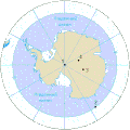
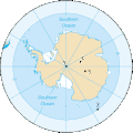
Pole-south uk.gif 330 × 330; 32 KB
-
Pole-south.gif 330 × 330; 11 KB
-
Priestley Glacier.png 488 × 487; 21 KB
-
Prince Albert Mountains.png 488 × 487; 21 KB
-
Scotia-Location.JPG 870 × 872; 107 KB
-
Vahsel Bay (cropped).png 194 × 192; 6 KB
-
Vahsel Bay.png 488 × 487; 22 KB


