Category:Locator maps of Andhra Pradesh (pre-2014)
Jump to navigation
Jump to search
Media in category "Locator maps of Andhra Pradesh (pre-2014)"
The following 16 files are in this category, out of 16 total.
-
Andhra Pradesh (1956-2014).png 197 × 203; 9 KB
-
Andhra Pradesh district location map Adilabad.png 250 × 233; 32 KB
-
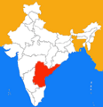
Andhra Pradesh in India (1956-2014).png 350 × 426; 76 KB
-
Andhrashiridimap.jpg 643 × 599; 210 KB
-
EastGodavariMap.png 628 × 599; 53 KB
-
In-ap kaart.jpg 460 × 482; 29 KB
-
India Andhra Pradesh.svg 1,500 × 1,615; 1.46 MB
-
Indien Andhra Pradesh.png 200 × 231; 18 KB
-
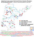
Jain Heritage sites map of Andhra Pradesh.jpg 1,181 × 1,310; 817 KB
-
Kakinada CN1.gif 667 × 619; 90 KB
-
Kosta.PNG 923 × 881; 69 KB
-
Kosta.png 923 × 881; 69 KB
-
Location of Pothumarru in AP,India.png 628 × 599; 108 KB
-
Madanapalli CN.gif 667 × 617; 89 KB
-
Pilgrimage sites map of Andhra Pradesh.jpg 1,642 × 1,686; 783 KB
-
Rayalaseema.png 628 × 599; 162 KB


